How troughs and ridges affect the weather in your neighbourhood

Every twist and turn of winds high in the atmosphere can have a huge effect on your day-to-day weather conditions
We hear about troughs and ridges all the time in our daily forecasts.
These features high in the atmosphere are responsible for the vast majority of the weather we experience down here on the ground.
How do troughs and ridges bring you rainy days or heat waves? Here’s a look at how twisting winds high in the sky directly affect your day-to-day conditions.
DON’T MISS: Why that wild weather map you saw on social media is probably bogus
High-flying winds drive our active weather
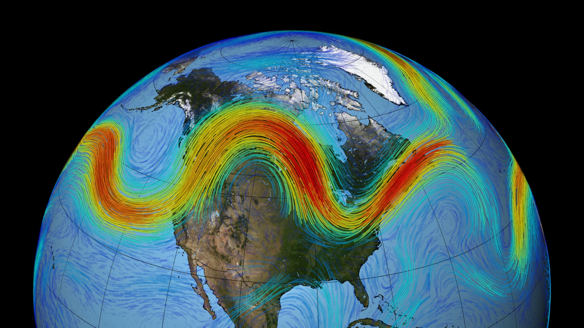
Much of our daily weather is linked to the jet stream, a narrow band of fast-moving winds found around the cruising altitude of passenger jets.
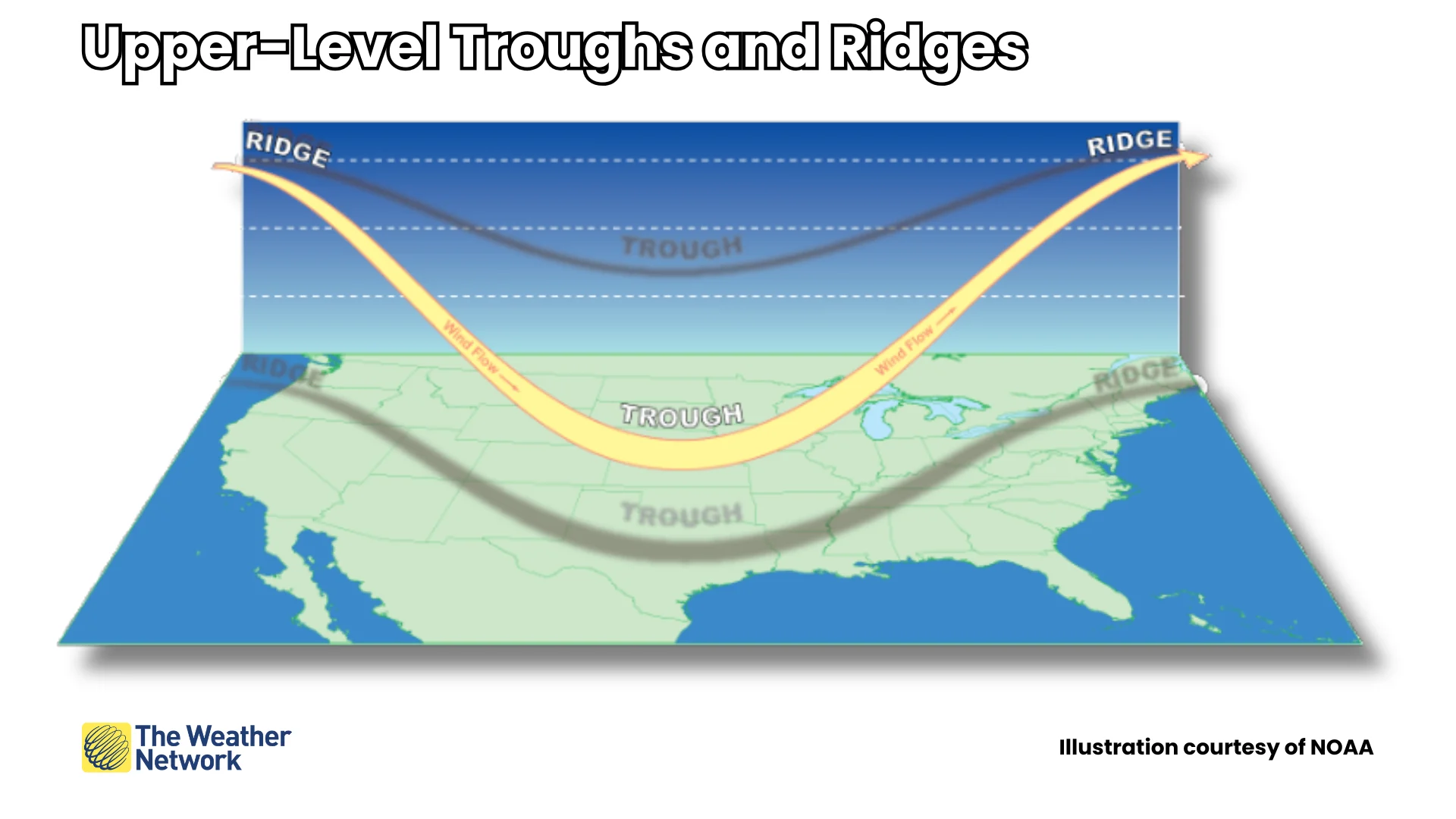
We’re most familiar with jet streams when we talk about troughs and ridges. These features earn their names from their appearance on weather maps. In the northern hemisphere, troughs generally dip toward the south while ridges arch toward the north.
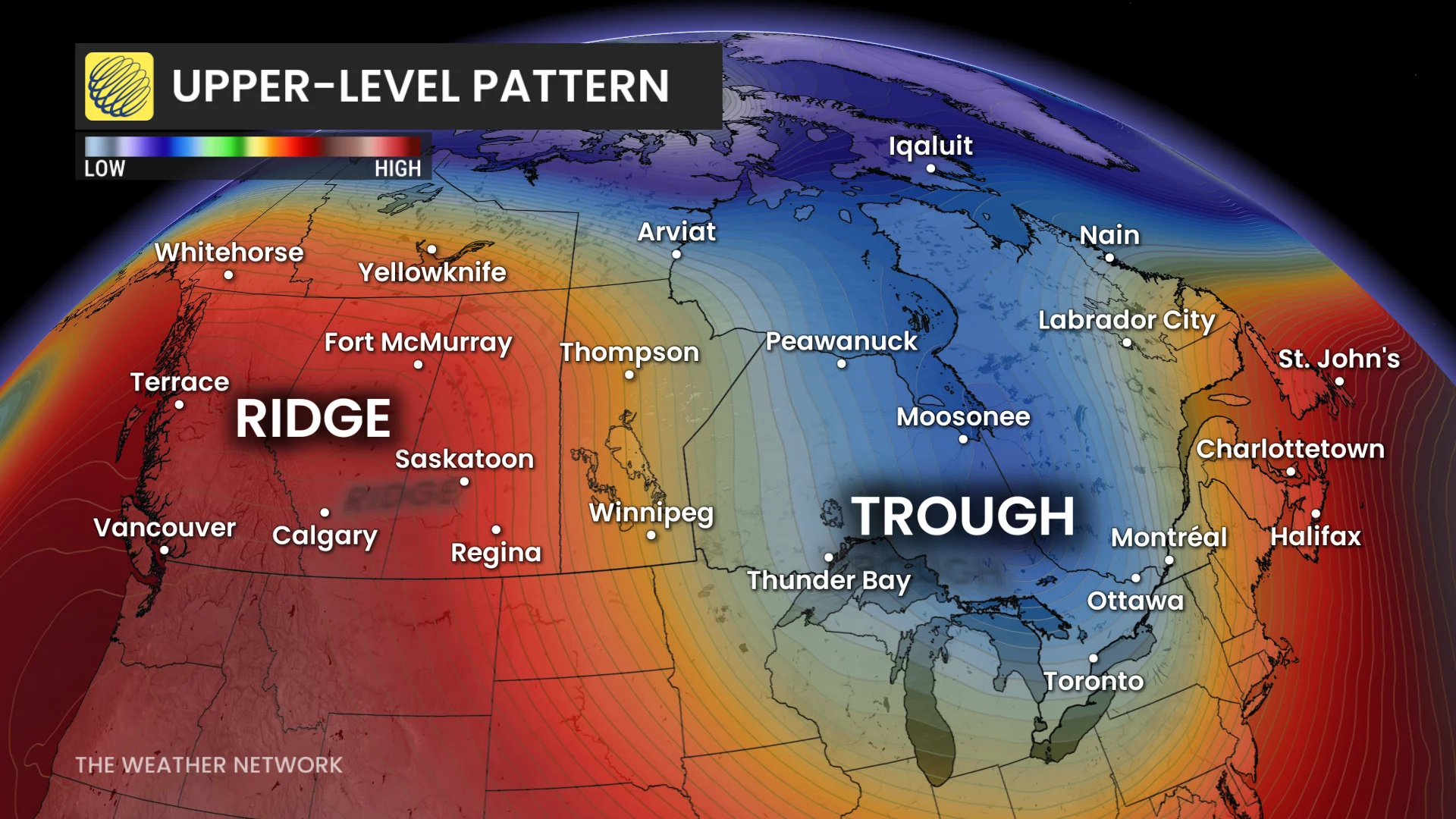
A trough is an elongated area of lower air pressure in the atmosphere. Troughs are associated with below-seasonal temperatures and unsettled weather.
A ridge is the opposite of a trough and features higher air pressure. Ridges usually bring above-seasonal temperatures and calmer weather to regions under their influence.
Winds speed up and fan out (diverge) as they swing around the base of a trough, while winds slow down and crash together (converge) as they round the top of a ridge.
It’s this divergence and convergence that helps influence so much of our weather down here at the surface.
Troughs lead to active weather
Winds spreading out as they blow through a trough leaves a void in the upper atmosphere that air from the surface has to rush upward to fill.
RELATED: Weather bombs are explosive storms that create ferocious conditions
Air rising upward leaves less air—and lower air pressure—near the ground. This large-scale lift can lead to unsettled weather ahead of a trough’s arrival.
Widespread clouds, rain, and below-seasonal temperatures are common when a trough approaches the area.
A robust trough in the winter can lead to bitterly cold temperatures and major episodes of snow or ice. A similar feature in the spring or summer can trigger severe thunderstorm outbreaks.
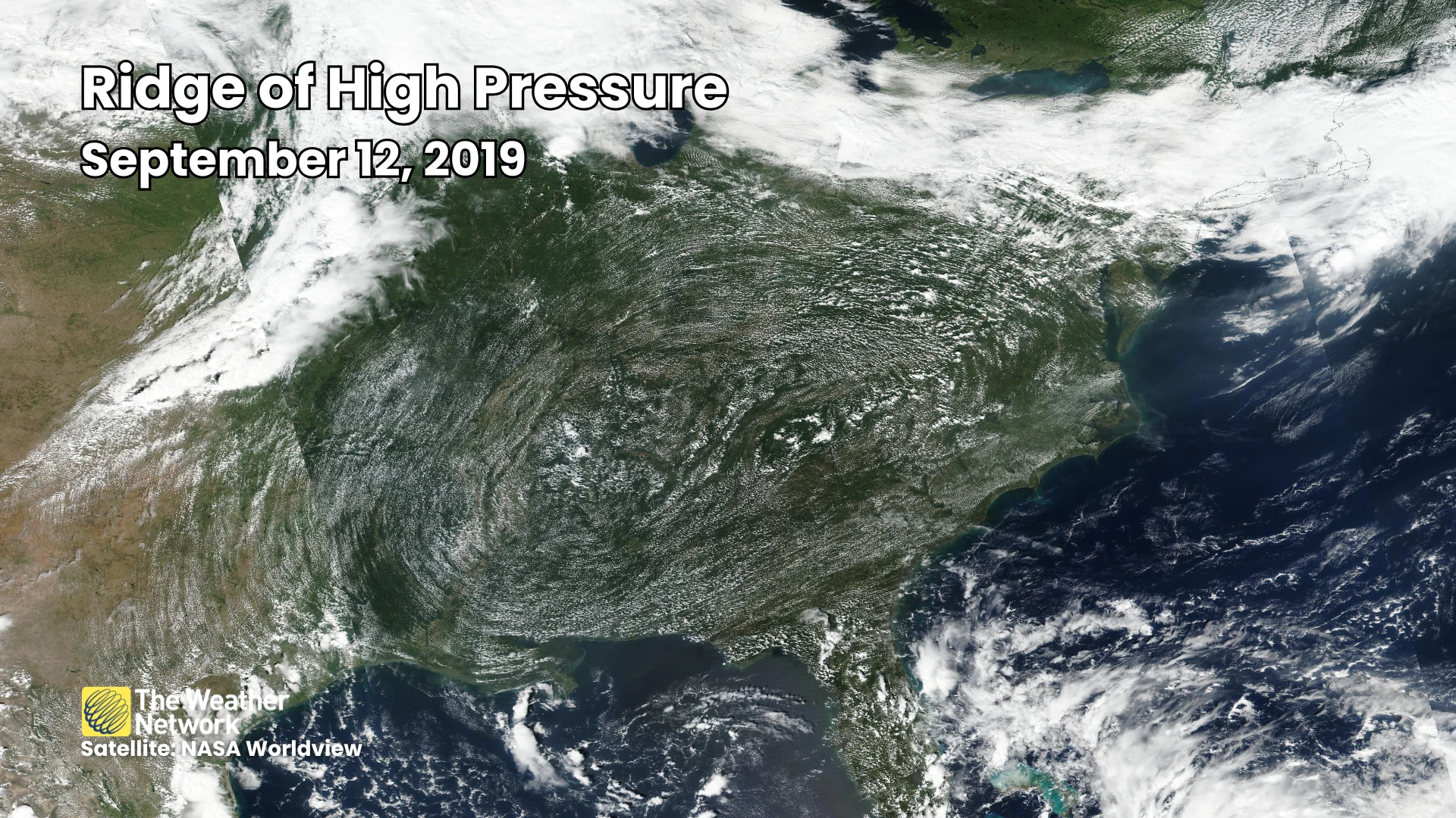
Ridges can bring calm skies, summer heat
Winds slow down and crash together as they blow around an upper-level ridge. This motion forces air to sink, warming up and drying out as it descends toward the surface.
Communities under the influence of ridging often experience relatively pleasant weather, with calm conditions and comfortable temperatures.
MUST SEE: Why extreme heat is one of the world’s deadliest weather disasters
Particularly strong ridges during the summertime can be responsible for dangerous heat waves. Sinking air, intense sunshine, and calm winds can lead to day after day of stifling temperatures and humidity.
A powerful ridge that remains in place for a long period of time is often called a heat dome. These rare and dangerous patterns can send temperatures soaring beyond 40°C in extreme cases, like the event we saw in British Columbia back in 2021.
The edge of a heat-producing ridge can also serve as the focus for strong to severe thunderstorm development. Some of summer’s most impactful thunderstorm events are mesoscale convective systems (MCS), which are organized lines of storms that can produce very strong winds, sometimes growing into full-blown derechos.
Header image courtesy NASA/Goddard Space Flight Center Scientific Visualization Studio.