Brace for large hail, strong winds as high heat fuels Prairie thunderstorms
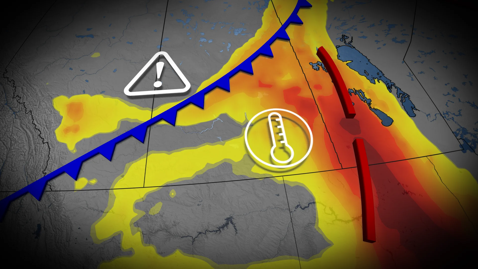
Intense heat and thunderstorms will dominate the weather across the Prairie provinces over the next two days
Summer conditions are heating up, with extreme heat and a risk of severe weather impacting the Prairies over the next couple of days.
DON'T MISS: The Weather Network's exclusive summer 2025 forecast
Heavy downpours, strong winds, and hail larger than two centimetres are potential risks with developing storms. While high thunderstorm energy is available, the formation and intensity of these storms remain conditional on key, atmospheric factors.
You'll want to stay updated on the weather alerts in your area as conditions can change quickly when severe weather hits.
Wednesday: Severe thunderstorms threaten large hail and strong winds
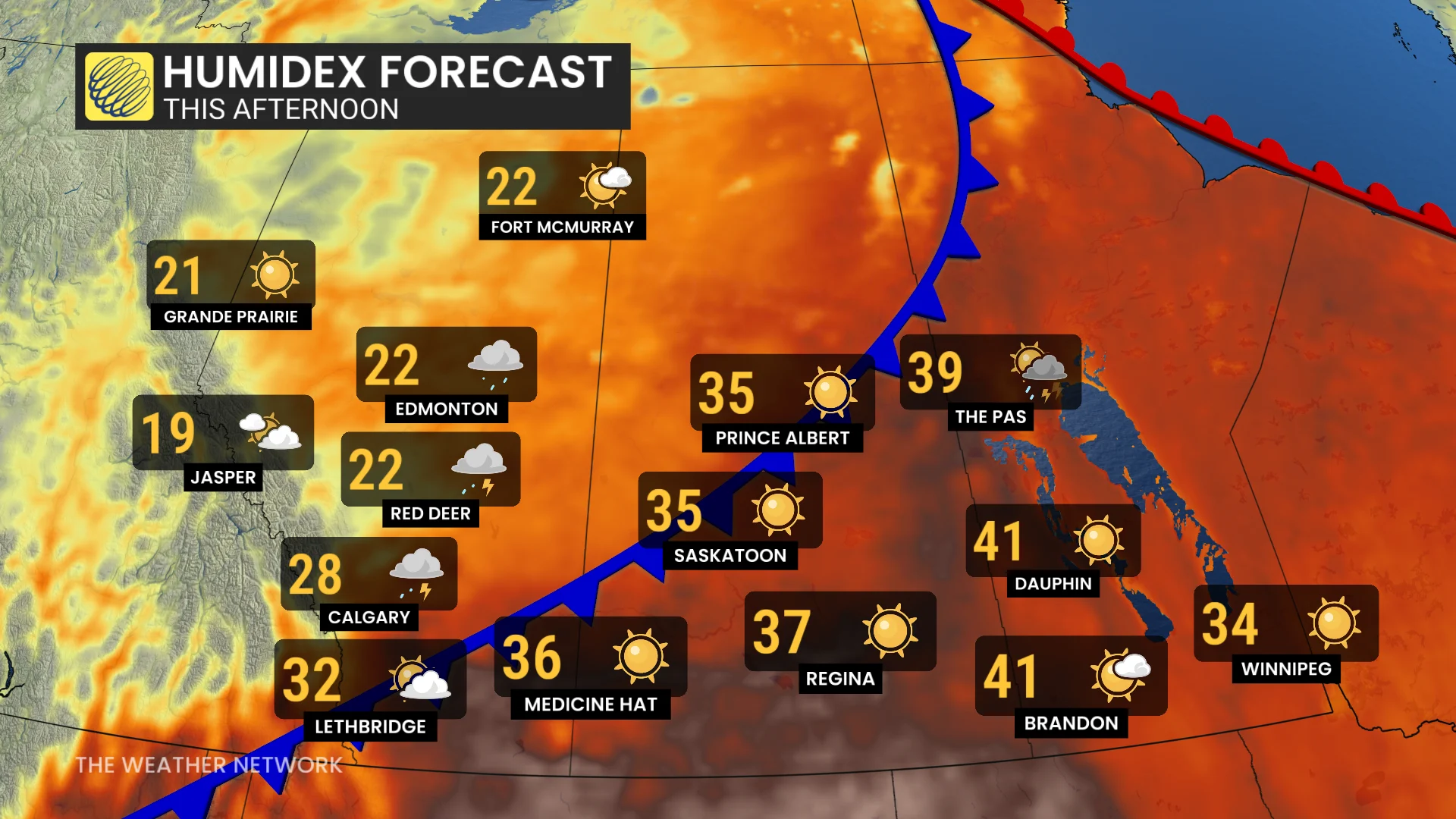
Heat warnings remain in effect for southern Alberta and Saskatchewan as temperatures climb into the upper 30s on Wednesday.
A cold front pushing south will bring in cooler air, likely triggering a severe thunderstorm complex in Alberta by Wednesday afternoon.
Thunderstorms will develop north of Calgary, near Red Deer, before tracking east of the QE2 corridor.
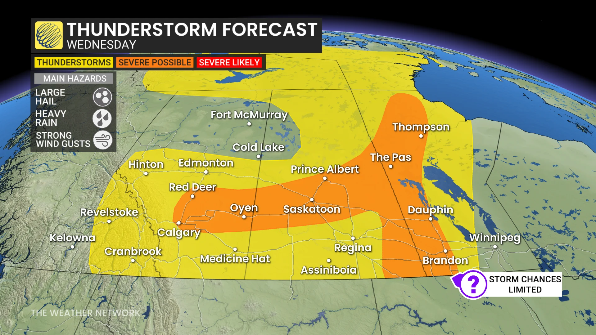
By the evening, the risk extends into Saskatchewan, bringing threats of strong winds, torrential rain, and hail exceeding two centimetres.
Conditions along the Saskatchewan-Manitoba border will depend on key, atmospheric triggers. High thunderstorm energy exists, but a cap of warm air aloft and limited storm triggers create considerable uncertainty for storm initiation.
Thursday: Storm risk shifts into Manitoba and northern Ontario, large hail threat remains
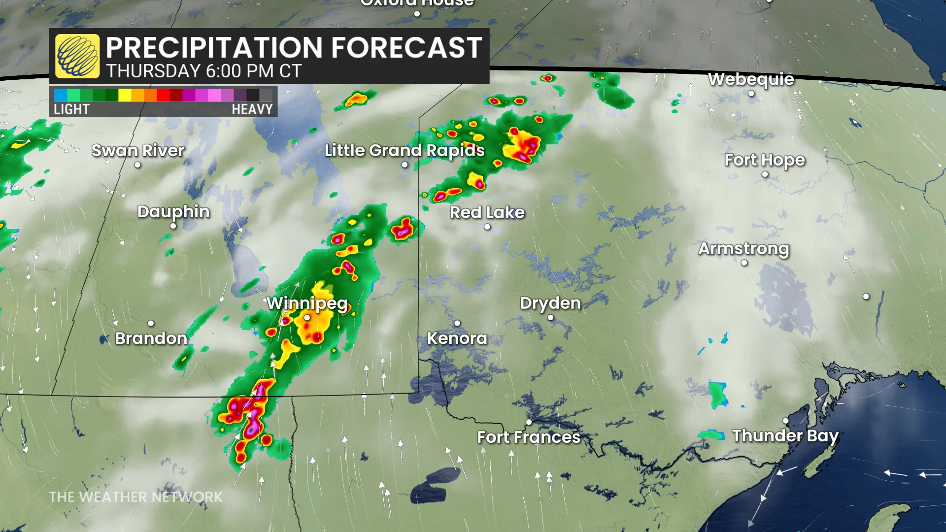
The cold front continues east into Manitoba and northwestern Ontario Thursday.
DON'T MISS: What’s the wettest month in your corner of Canada?
There will be a threat for mid-afternoon, rapid storm development along the lake breezes surrounding the Interlake region in Manitoba. By the late afternoon, severe storms are possible along the provincial borders.
Extremely large hail up to three or four centimetres is possible, especially in humid conditions.
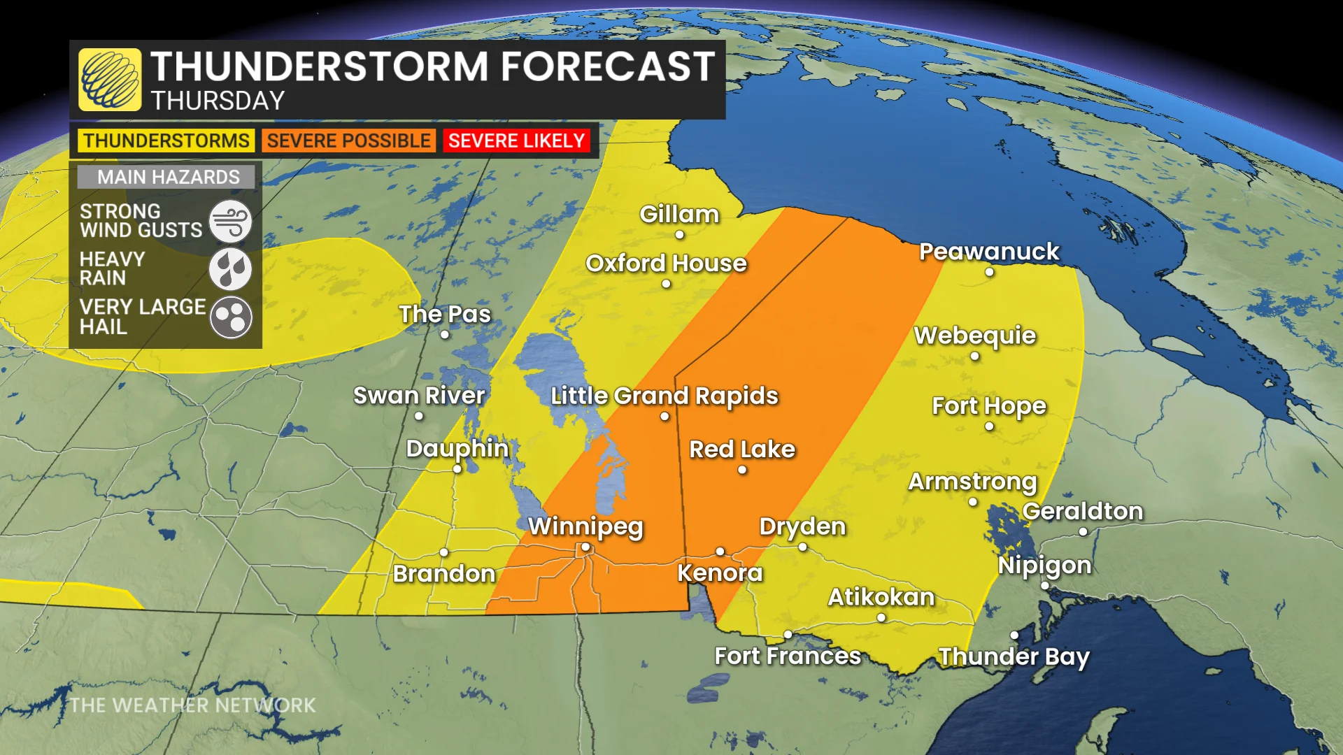
Models were initially hesitant to develop a continuous storm threat from North Dakota through the Interlake region, but the latest models are more confident in a persistent line of storms by the time the front reaches Winnipeg.
Isolated, severe storms will be possible as far north as Hudson Bay.
Make sure to stay weather-aware and pay attention to local weather alerts in your area as conditions can change quickly when severe weather hits.
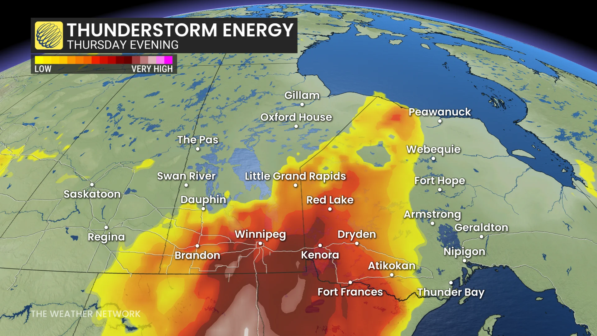
Conditions will be very humid in Winnipeg, with humidex values in the 40s.
The cold front will lower temperatures, returning much of the region to seasonal conditions by the weekend.
Be sure to check back for the latest weather updates across the Prairies