Very large hail threat with Thursday storm risk in Manitoba, NW Ontario
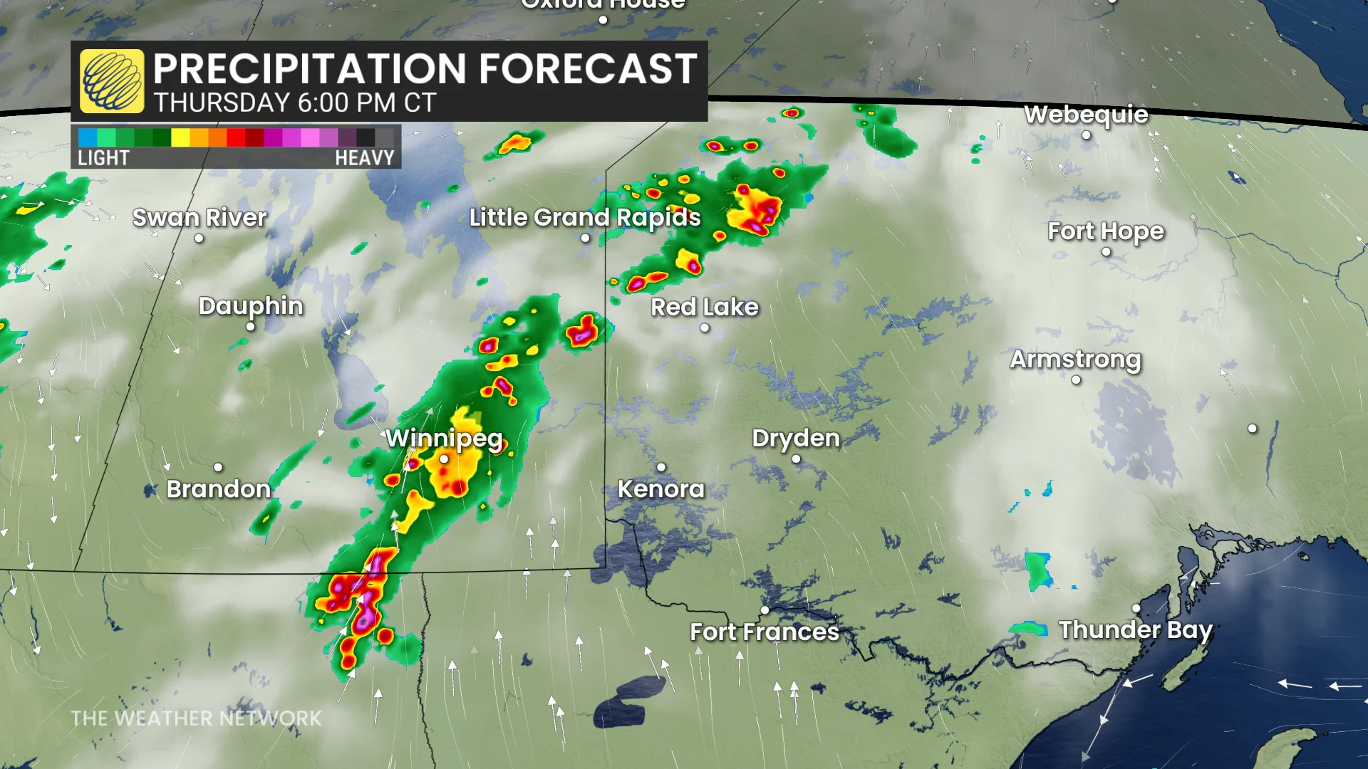
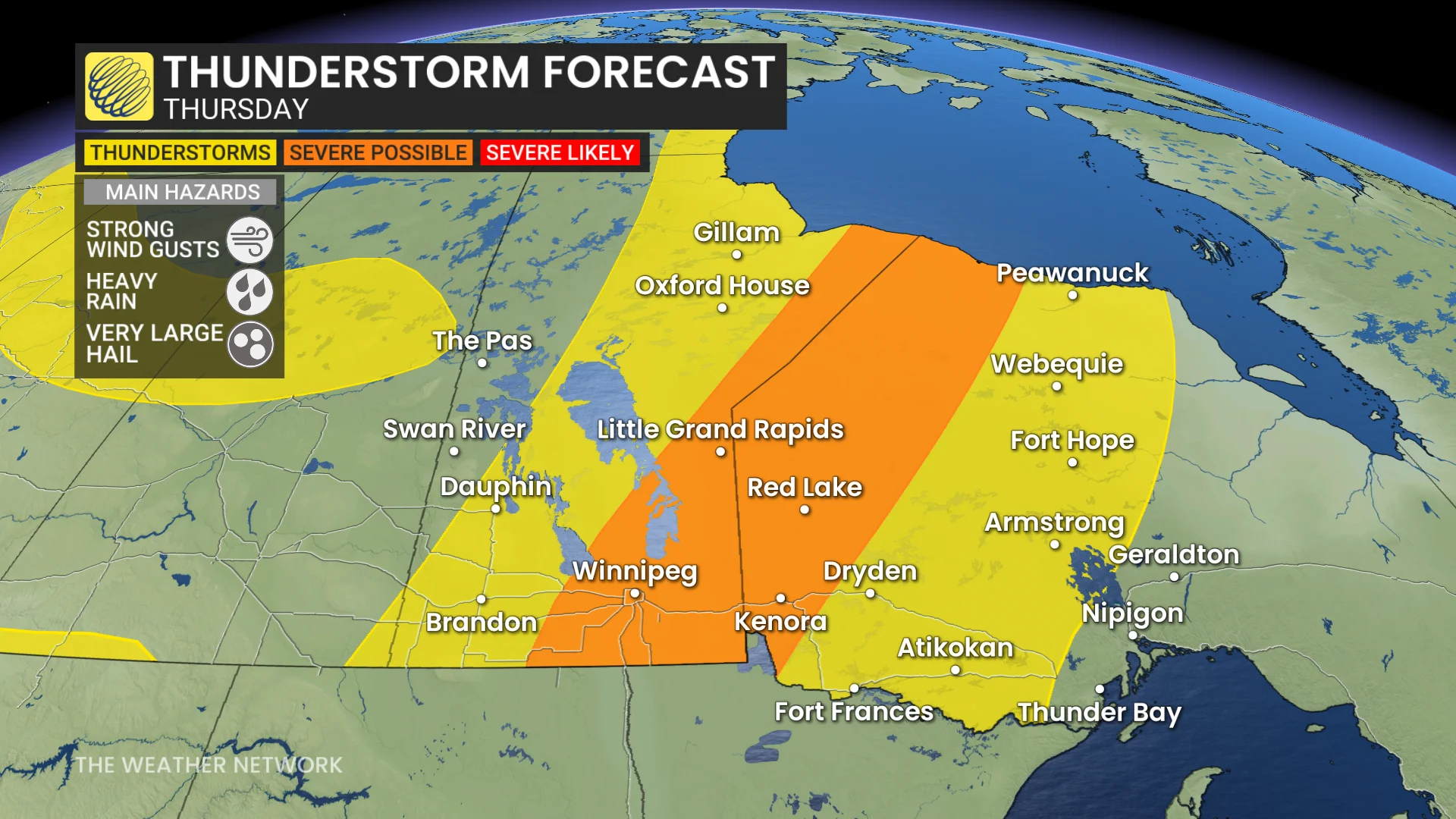
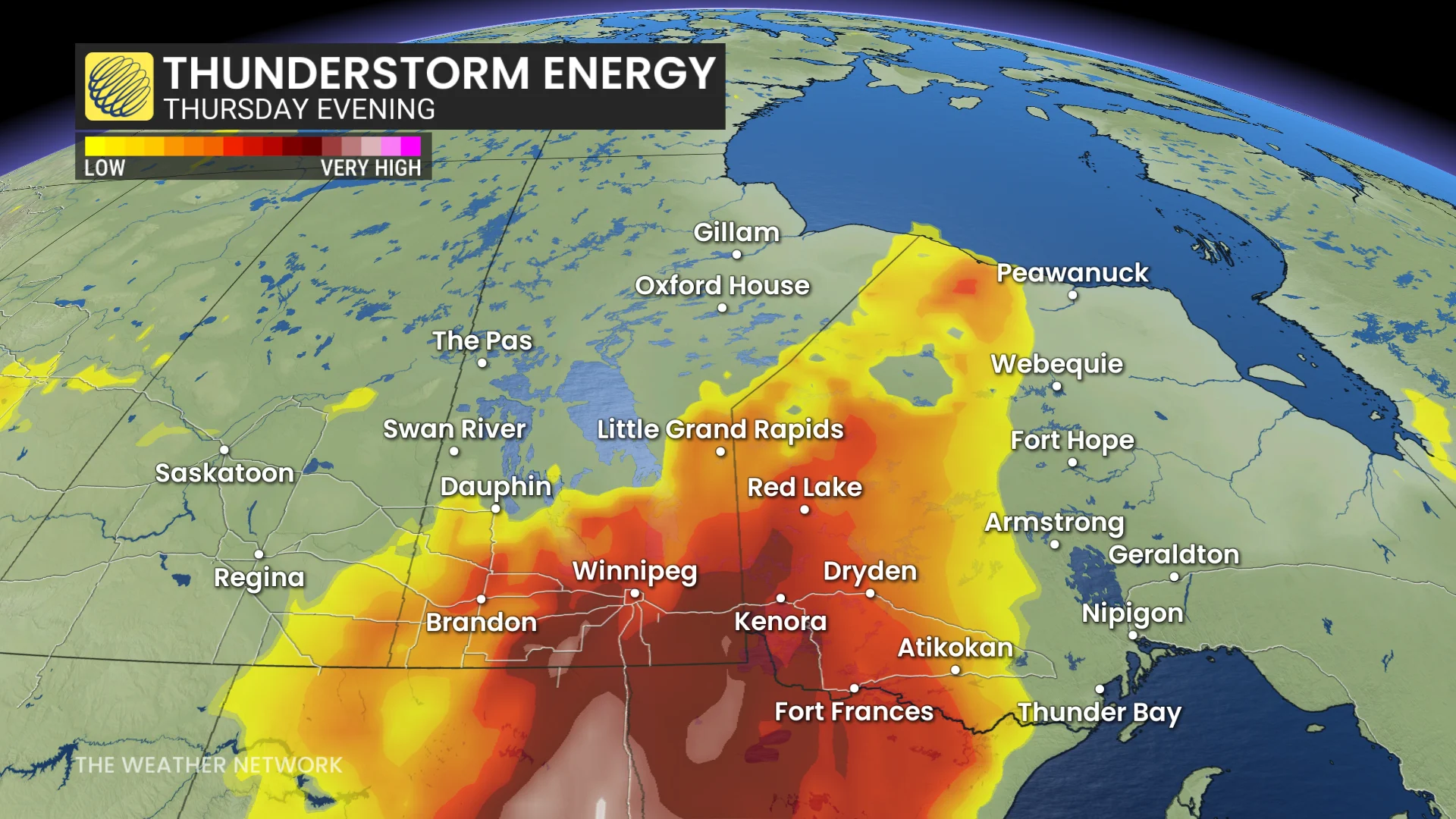
Severe weather will pop up again on Thursday on the Prairies, with the focus moving east into southern Manitoba and northwestern Ontario where very large hail will be a threat
The heart of the summer season is seeing plenty of severe weather opportunity on the Prairies.
Wednesday evening saw tornado watches issued in parts of central Alberta, but no warnings materialized out of them while they were in place. Thursday will see the severe chance shift away from Alberta and Saskatchewan and move into southern Manitoba and northwestern Ontario.
DON'T MISS: The Weather Network's exclusive summer 2025 forecast
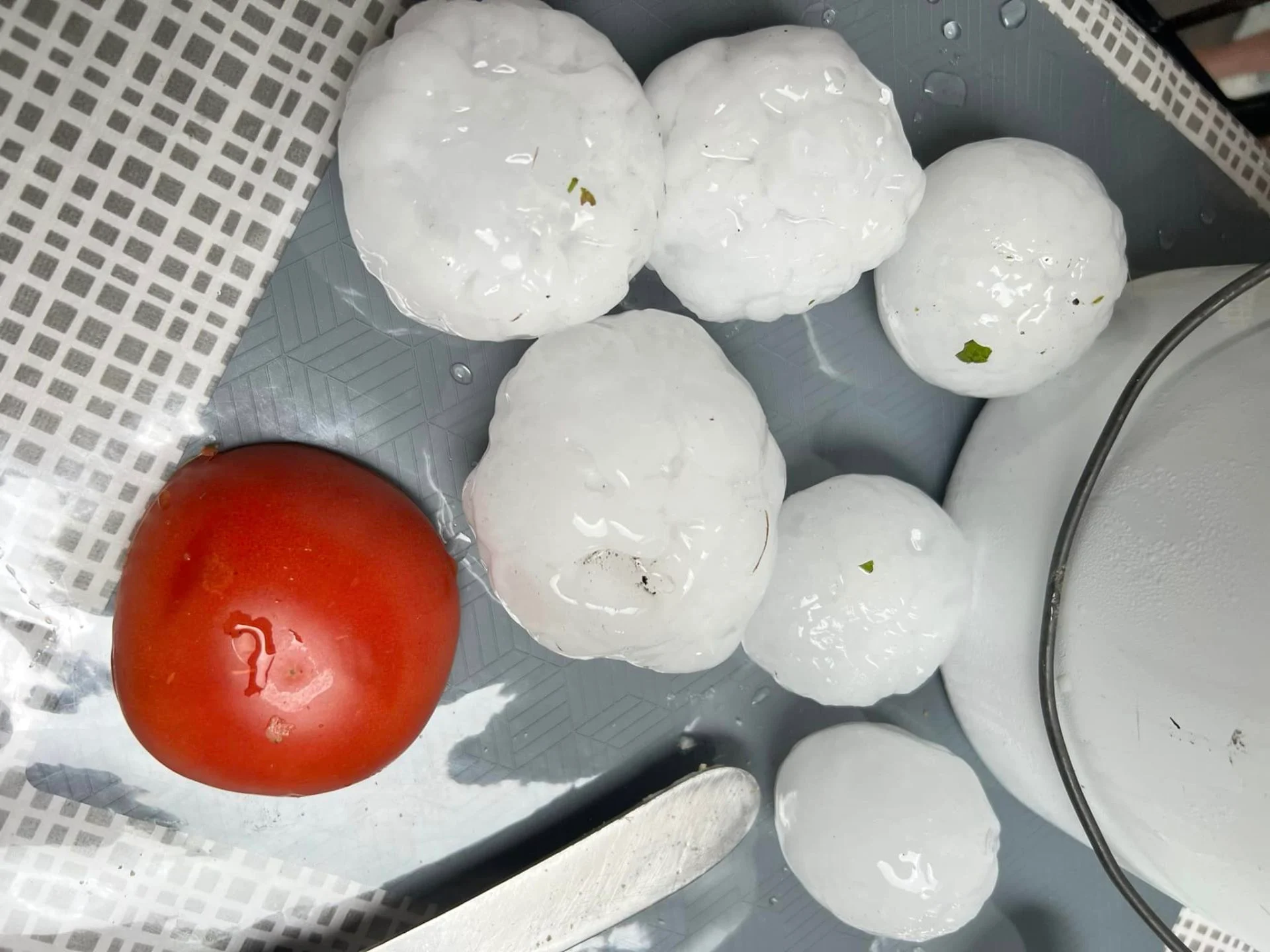
Very large hail, possibly as large as two to four centimetres in size, will be the main hazard, alongside strong wind gusts and heavy rain.
You'll want to stay updated on the weather alerts in your area as conditions can change quickly when severe weather hits.
Thursday: Storm risk shifts into Manitoba and northern Ontario, large hail threat remains
The cold front continues east into Manitoba and northwestern Ontario Thursday.
DON'T MISS: What’s the wettest month in your corner of Canada?
There will be a threat for mid-afternoon, rapid storm development along the lake breezes surrounding the Interlake region in Manitoba. By the late afternoon, severe storms are possible along the provincial borders.
Extremely large hail up to three or four centimetres is possible, especially in humid conditions.
Models were initially hesitant to develop a continuous storm threat from North Dakota through the Interlake region, but the latest models are more confident in a persistent line of storms by the time the front reaches Winnipeg.
Isolated, severe storms will be possible as far north as Hudson Bay.
Make sure to stay weather-aware and pay attention to local weather alerts in your area as conditions can change quickly when severe weather hits.
Conditions will be very humid in Winnipeg, with humidex values in the 40s.
The cold front will lower temperatures, returning much of the region to seasonal conditions by the weekend.
Be sure to check back for the latest weather updates across the Prairies
Thumbnail courtesy of Donna Clarke/Facebook, taken in Fisher River, Man.