Burst of July snow follows a dramatic temperature drop. Here's where

A wintry blast is occurring in parts of Canada after a sharp temperature drop, just 24 hours after a heat warning was in place
Talk about a weather whiplash.
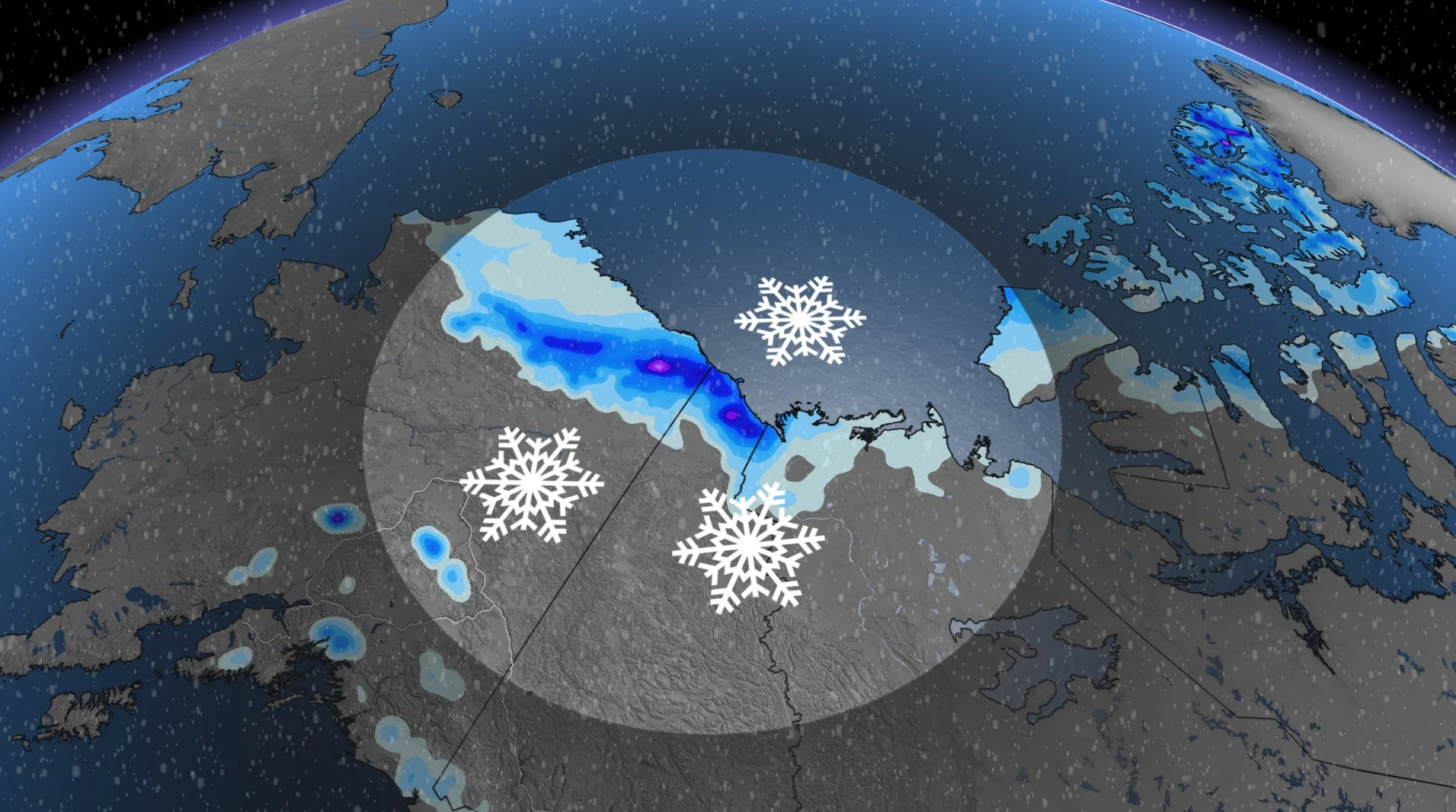
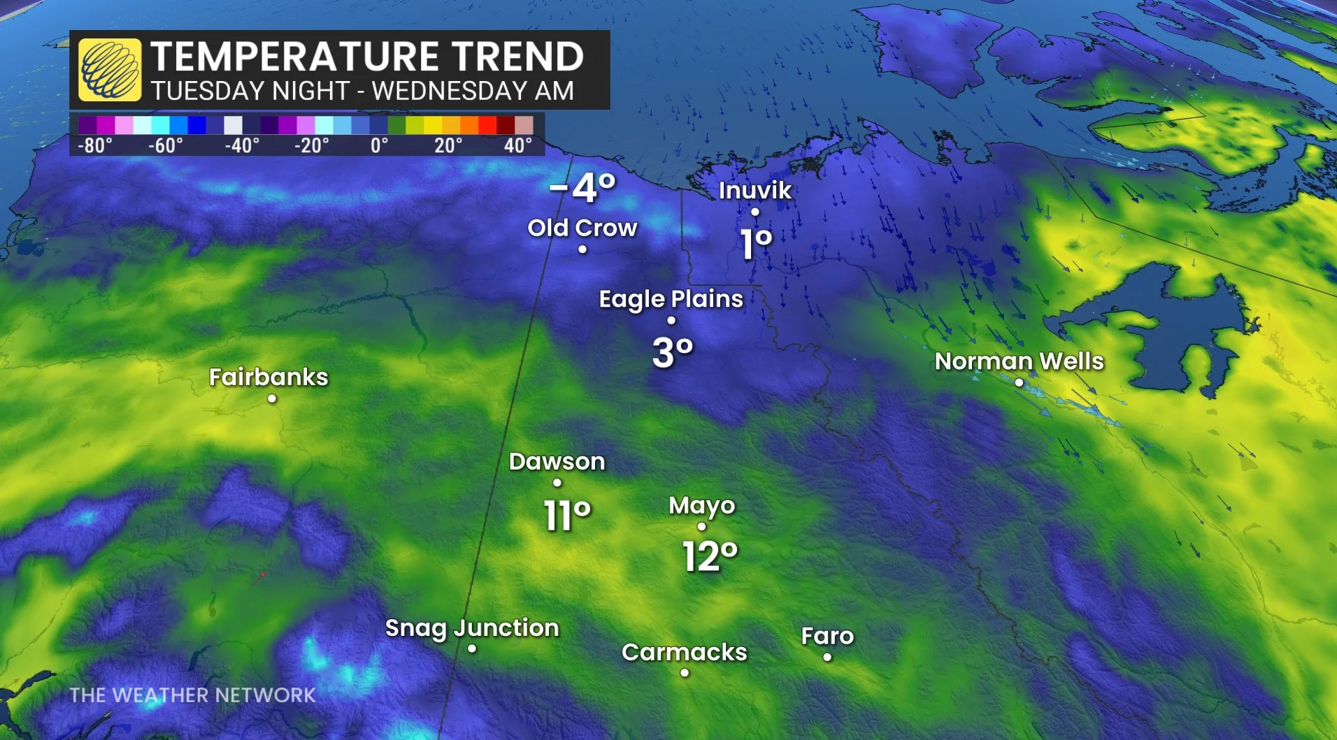
Twenty-four hours ago, the northern Yukon was enjoying a blast of summer heat, like much of Canada. And now, a special weather statement, instead of a heat warning, is in place for northern parts of the territory--warning of wintry weather through Wednesday afternoon.
SEE ALSO: Severe weather set to hit multiple parts of Canada this week
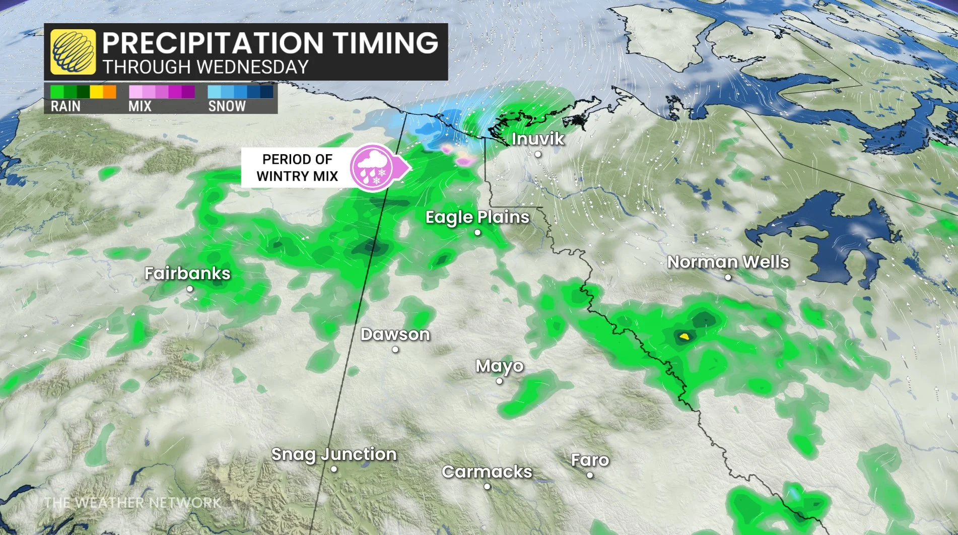
According to Environment and Climate Change Canada (ECCC), a significant drop in temperatures began on Tuesday after northerly winds off the Beaufort Sea increased to moderate to strong speeds, leading to a mix of wintry weather, including snow, in the northern Yukon.
The special weather statement covers the northern Yukon, including Old Crow and northern sections of the Dempster Highway.
Temperatures will plummet from recent, near-record warmth to near-record cold--close to or below zero Tuesday overnight. Precipitation will start as rain and change over to, or become mixed with ice pellets and/or snow.
In addition to the wintry precipitation, there will be a chill. Moderate winds, in combination with low temperatures, may produce wind chill values down to -5 to -10 Tuesday overnight and Wednesday morning.
That comes after a heat warning was in place in Old Crow, Yukon, from Saturday to Monday. Temperatures soared to 28.1 C on Saturday and nearly hit the 30-degree mark on Sunday (29.7 C).
The short-lived heat came courtesy of a ridge of high pressure in Northern Canada.
WATCH: A normal July in Canada can look different for everyone
With files from Matthew Grinter, a meteorologist at The Weather Network.