
Post-tropical storm Chantal brings heavy rain to the Maritimes
This week will bring the Maritimes multiple opportunities for thunderstorms, with Tuesday featuring another chance for parts of the region
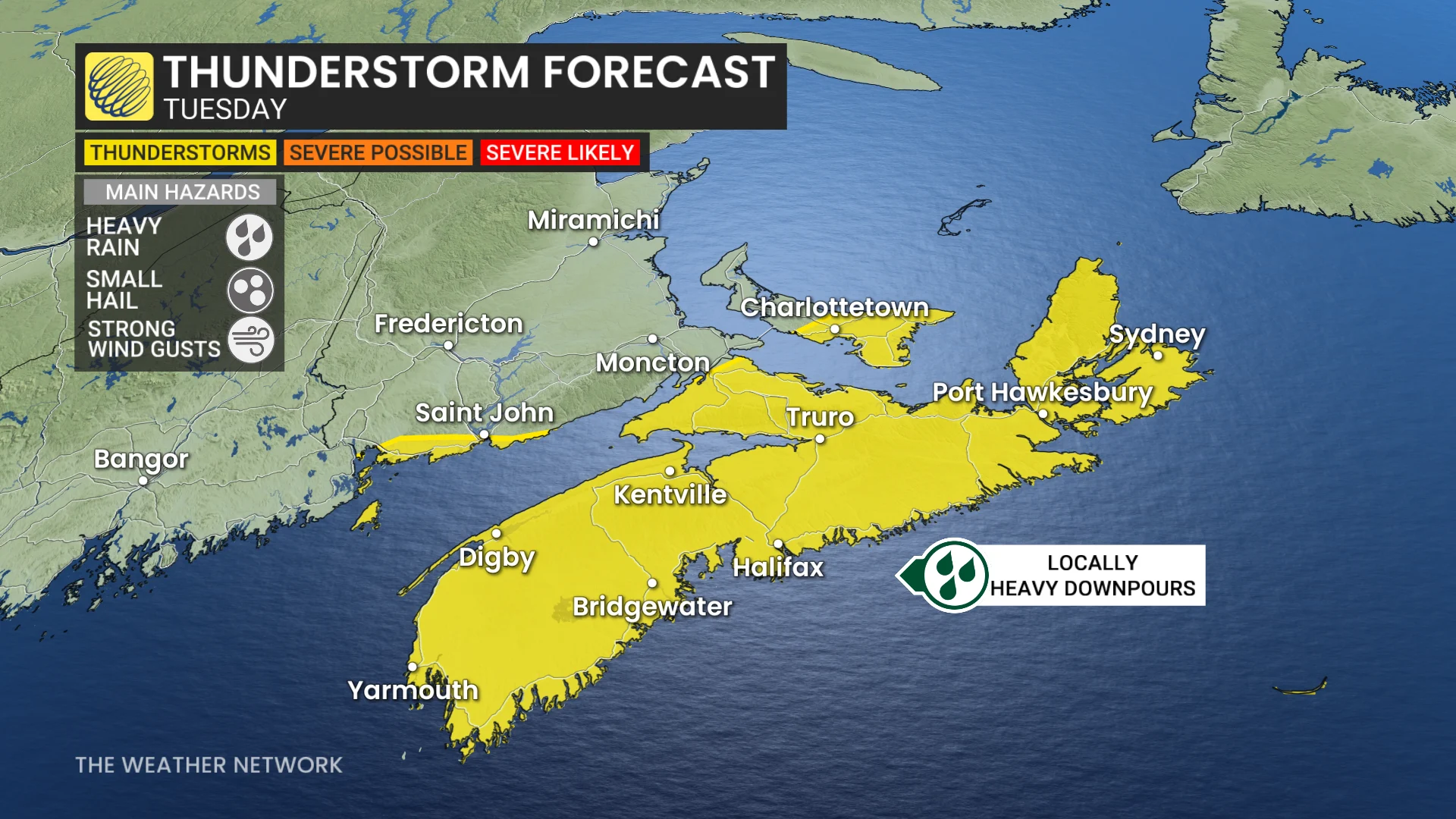
Following a stormy Monday evening in parts of New Brunswick, which included a tornado watch for parts of the region, the risk of thunderstorms will persist on Tuesday.
However, the activity is expected to shift mainly to Nova Scotia, with remnant moisture from post-tropical storm Chantal bringing heavy downpours and locally high rainfall totals. Widespread special weather statements were issued early Tuesday morning.
WATCH BELOW: Heavy rains caused localized flooding in Halifax Nova Scotia
SEE ALSO: A normal July brings Canada drought, downpours, and dizzying heat
Be sure to monitor local weather alerts and incoming conditions throughout the day.
Locally heavy rain in a short period of time on Tuesday
Moisture from the remnants of Chantal will impact much of the southern Maritimes on Tuesday, bringing periods of heavy rain and localized downpours.
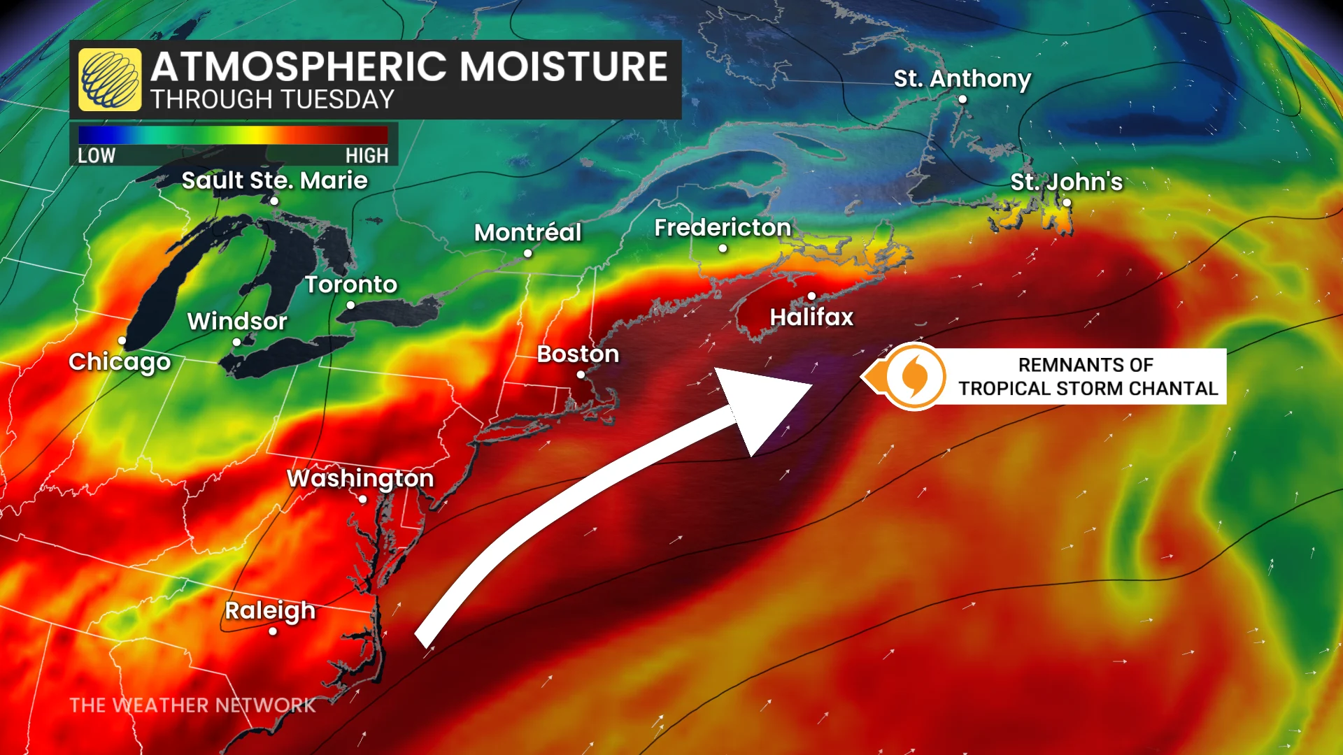
Elevated atmospheric moisture across Nova Scotia will maintain instability, supporting a continued storm risk throughout the day.
Any storms that form should remain below warning criteria, but could bring heavy rain, small hail and strong winds.
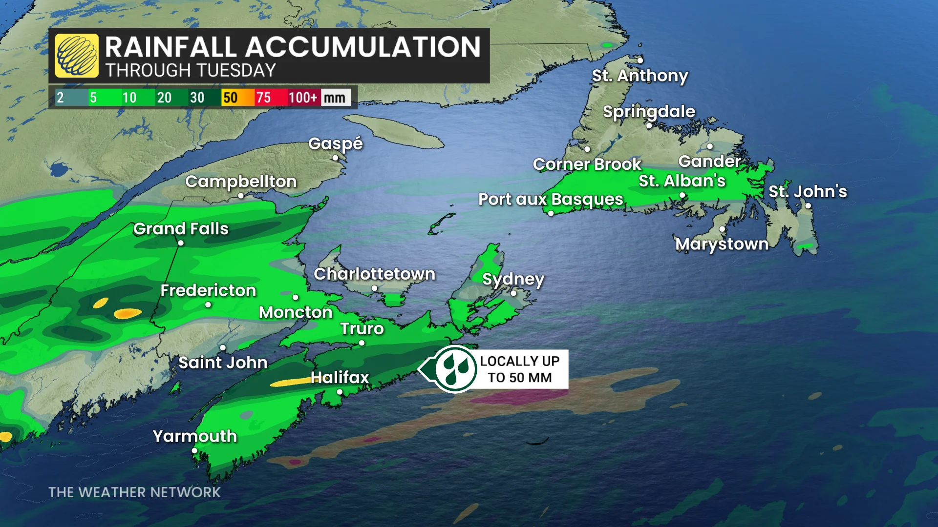
By Tuesday afternoon and evening, rainfall may ease slightly, but is not expected to fully clear the province. Isolated heavy downpours may still develop.
Rainfall amounts will vary significantly with thunderstorms, but some computer models suggest localized totals could reach up to 50 mm by Tuesday afternoon.
Conditions are forecast to turn calmer and more settled on Wednesday and Thursday before active weather is expected to return on Friday.
Stay tuned to The Weather Network for the latest forecast updates in Atlantic Canada.