Canada's 2025 wildfire season takes a break, but for how long?
After a fast and early start to Canada's 2025 wildfire season, shifting weather conditions have helped to quell the rapid rate of new blazes in recent weeks. But, will that trend continue?
While Canada's wildfire season got off to a fast start this year, some weather pattern changes in recent weeks have slowed the rate of new blazes.
For example, 60 new wildfires were reported in the past week, a number that is dramatically lower than what popped up from the middle of April to the end of June--when the country saw approximately 150-300 new blazes a week.
DON'T MISS: The Weather Network's wildfire hub
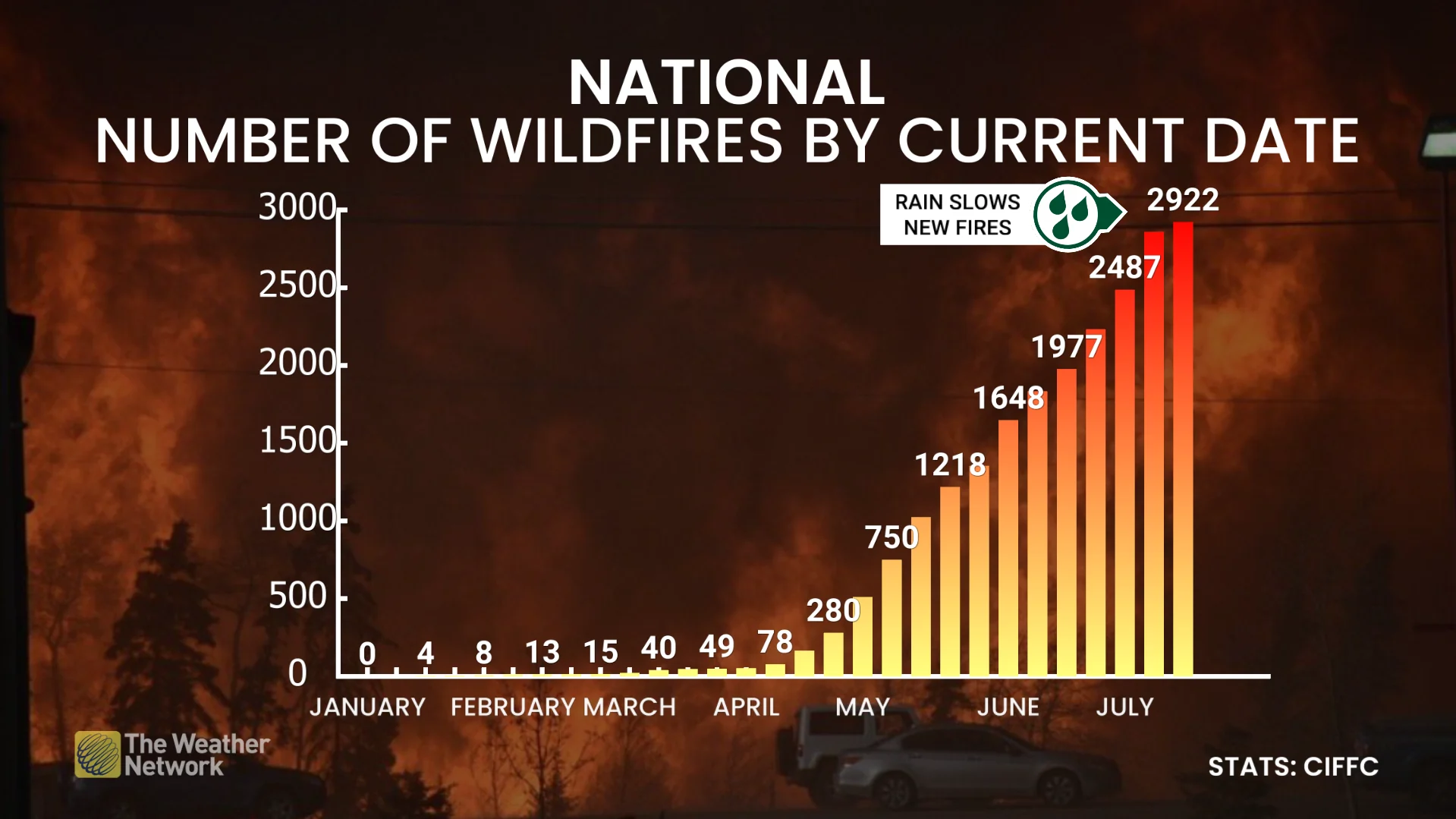
For the actual number of wildfires this year, Canada has been hovering near normal, with a slight uptick to above normal in some weeks, but overall, the figure is still considered normal.
What can Canada expect going forward this season?
The Prairies, which have seen most of the wildfires this year--along with B.C.--have experienced several rainfall-heavy events since the spring--helping to lessen the risk. But, a reversal of good weather fortunes is about to occur.
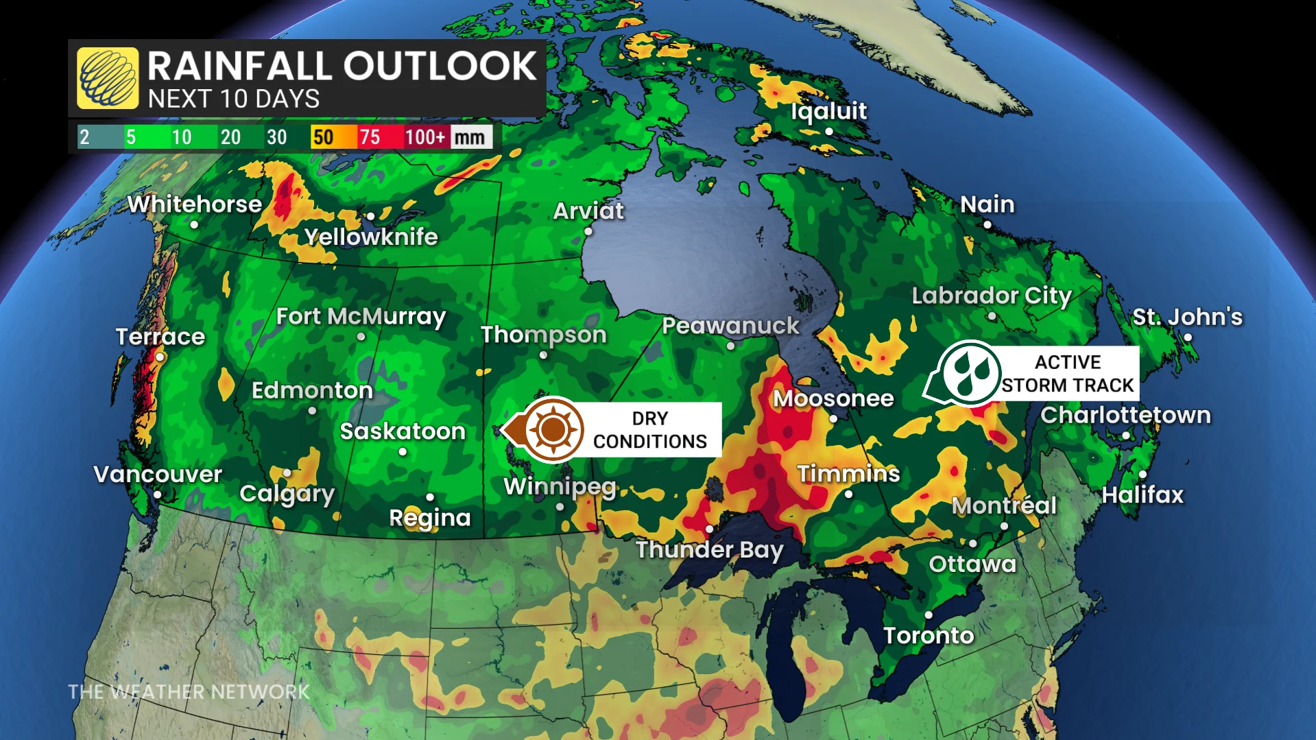
The wet conditions the Prairies have seen over the past couple of weeks have slowed the rate of new fires developing, but that is about to change again.
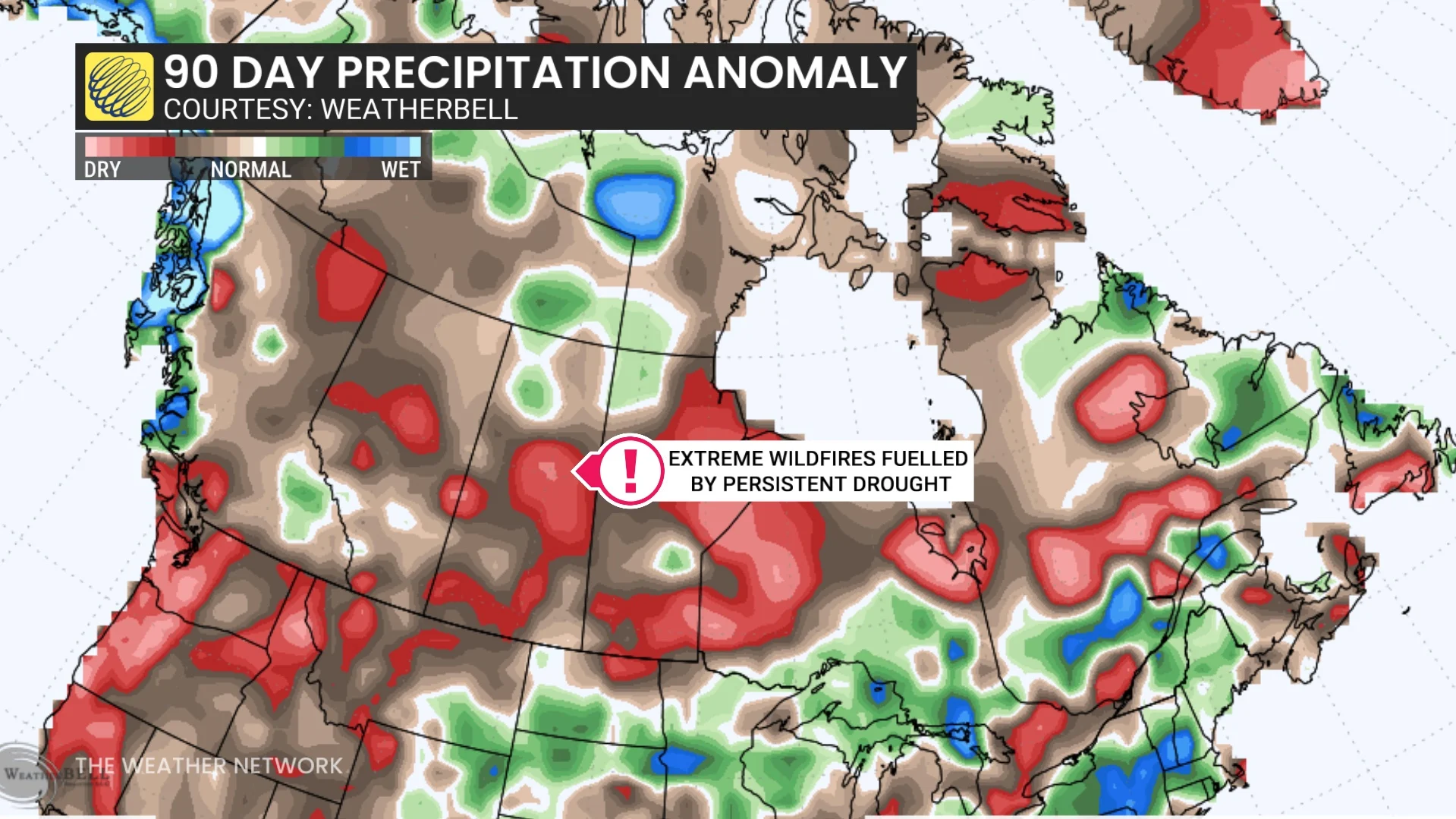
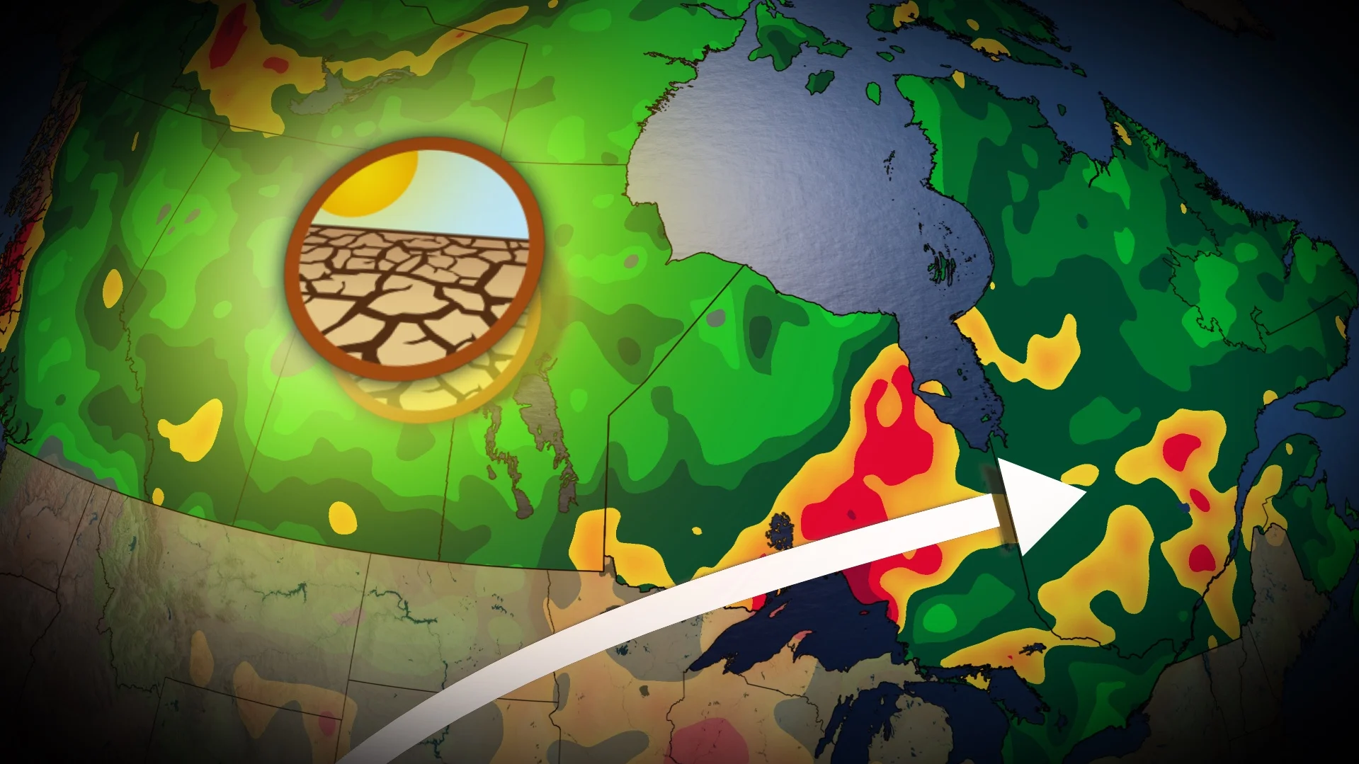
The central Prairies and B.C. can expect a drying trend to take place once again, a certainty in fuelling more wildfires. In fact, multiple communities in northern Saskatchewan have declared states of emergency due to the drought conditions still in play.
Although the recent rain has slowed the rate of new fires on the Prairies, the soil moisture and drought conditions aren't automatically fixed. So, when there is a dry stretch in the West, conditions will return to where they were prior to the rainfall periods.
It's not all bad news in Canada, however. The East is faring much better by comparison.
A wetter pattern in the spring and early summer helped minimize wildfire conditions in Ontario and Quebec, although the season has been far from non-existent there. But the good news is that the wet pattern continues in northern Ontario and central Quebec, keeping the wildfire threat at a lower level than their West counterparts.
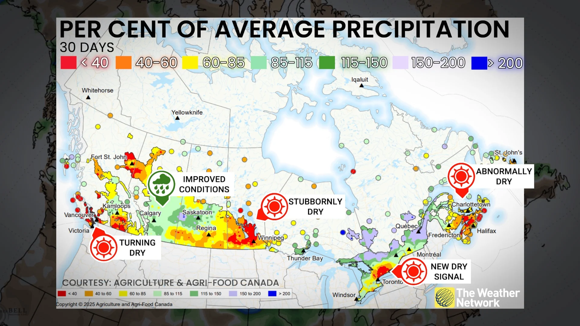
Moving southward and eastward, the forecast isn't as positive. The Greater Toronto Area (GTA) and surrounding areas in southern Ontario have been drier than normal during the past couple of weeks.The Maritimes have seen a similar situation, with some thunderstorms, but are lacking any widespread rain to keep the fire risk at bay.
With files from Matthew Grinter and Tyler Hamilton, meteorologists at The Weather Network, and Nathan Howes, a digital reporter at The Weather Network.