End of late-summer heat wave may be in sight for parts of B.C.
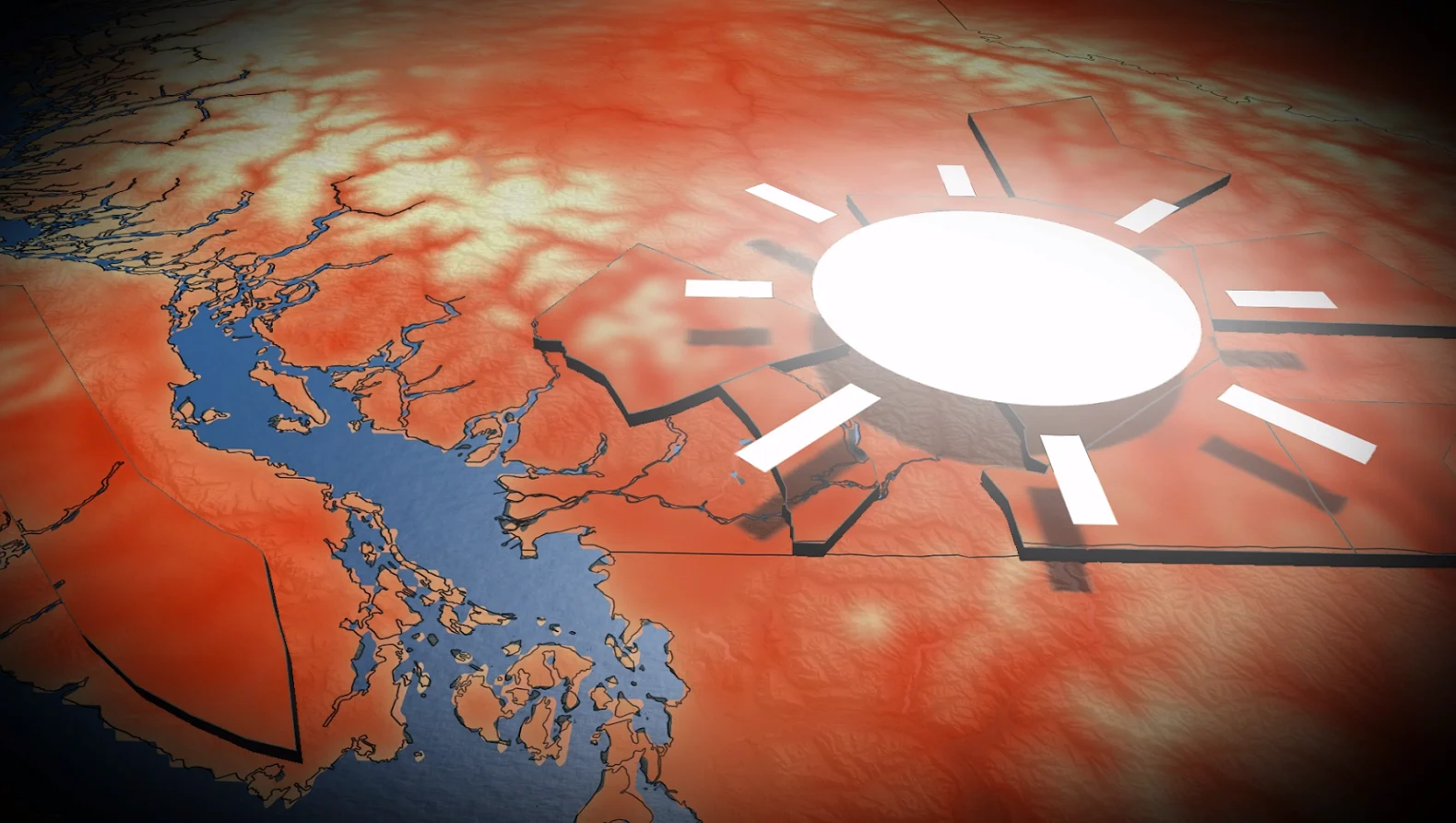
Parts of B.C. are basking in a late-summer heat wave just days before the official start of fall
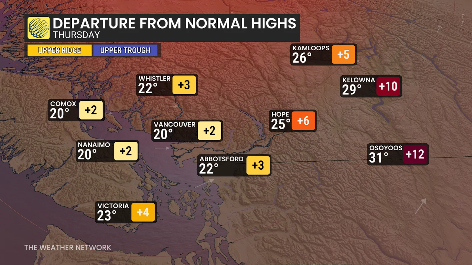
Late-summer heat continues across B.C’s valleys on Thursday ahead of a chilly pattern change coming up.
Heat and sunny skies in the valleys that have persisted through the week will continue into the weekend while the coast gets a soaking of rain.
Canada's 2025 Fall Forecast: An extended pause could redefine the season ahead
Enjoy this burst of heat while it lasts, though, because this may be the final round before fall temperatures finally take over for the season.
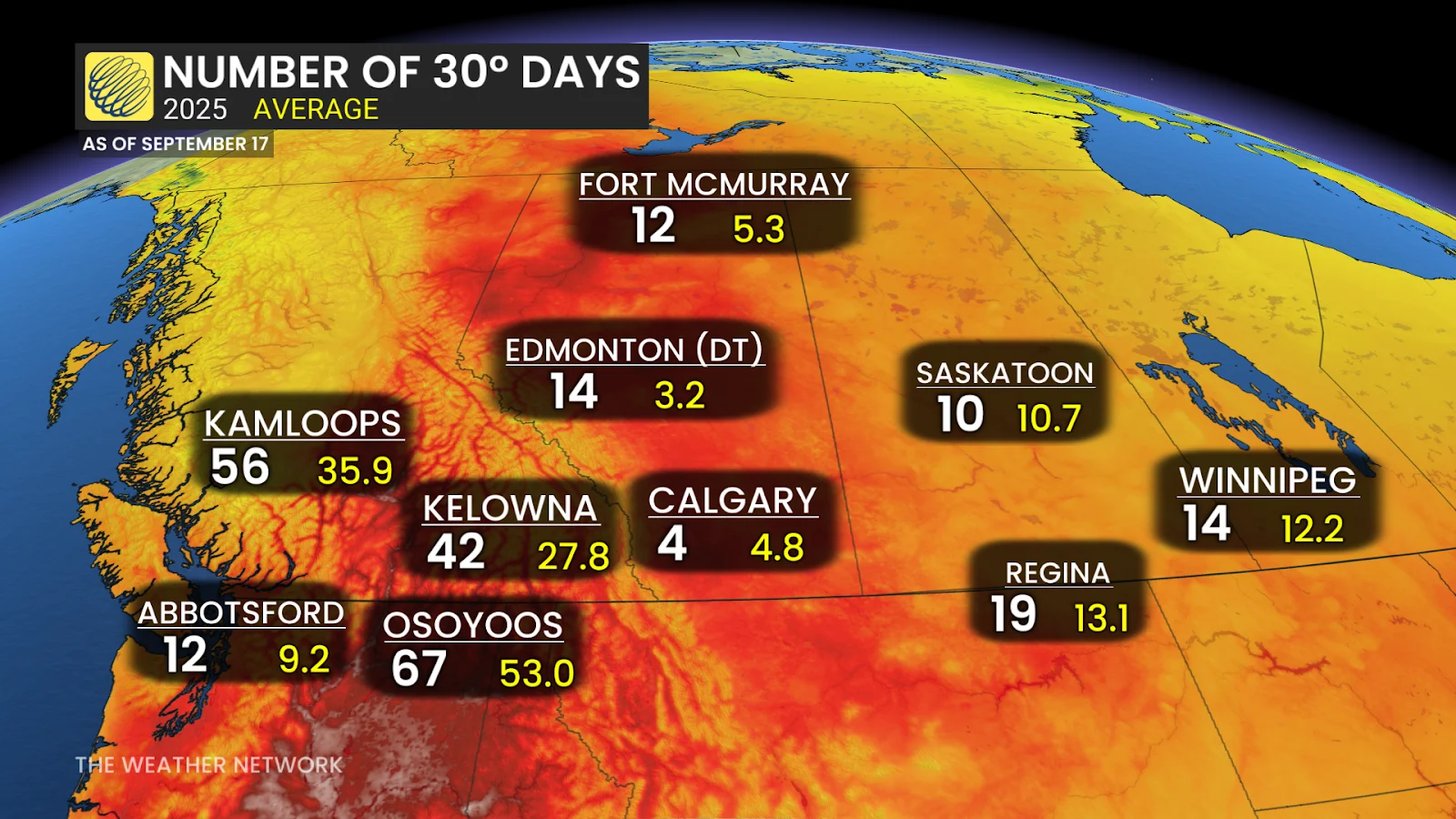
So far Osoyoos has has had 67 30-degree days this year. They will have another opportunity to see 30-degree readings on Saturday, though. This could very well be the last chance to bring that count up for the year. Meanwhile, the normal for this time of the year is 20°C.
SEE ALSO: Weather: The secret ingredient behind the perfect apple
There have only been a handful of dates of recorded 30°C readings on or after Sept. 20 in Kamloops (nine to be exact). The most recent occurred on Sept. 24, 2011, and the latest took place on Oct. 8, 1911.
The heat is anticipated to peak Thursday with a forecast of 31°C. Friday will be slightly cooler, but still hot, in the Interior, but we will see temperatures rise slightly along the South Coast.
However, the start of the rainy season is in sight. It may miss the Interior, but it will offer cooler, more seasonal temperatures in the long-range.
Widespread rain is expected to develop for the South Coast region this weekend as an atmospheric river tracks in. A wetter-than-normal pattern is expected for the final week of September with a few systems tracking into the region, bringing the potential for heavy rain and cooler temperatures.
Stay with The Weather Network for all the latest on conditions across B.C.