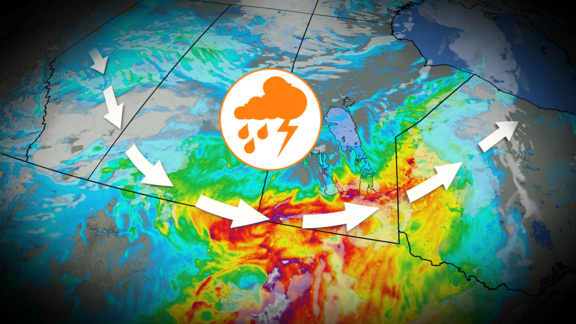
Severe thunderstorm risk with very large hail as two instability zones develop
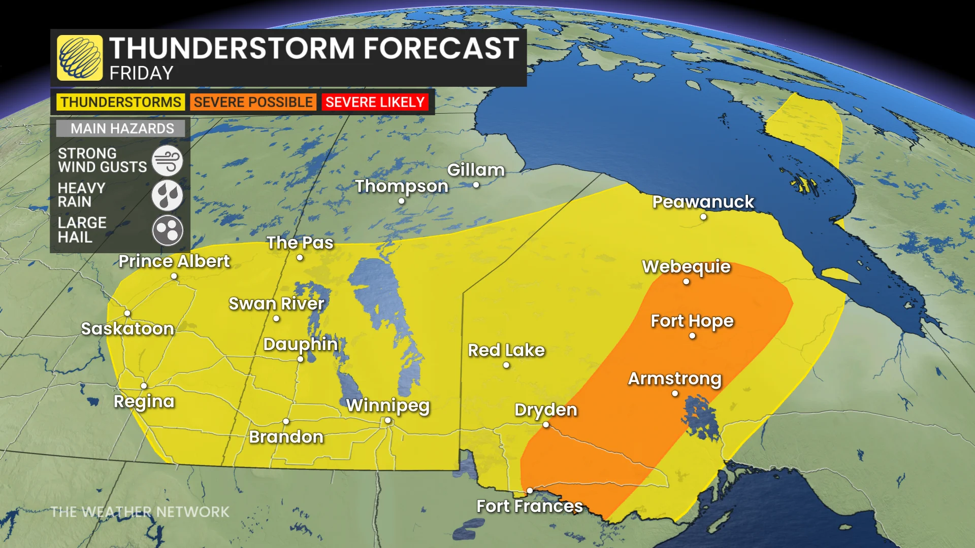
The multi-day thunderstorm threat continues over the Prairies into Friday, with the risk for very large hail, potentially reaching 3-4 cm in size. Powerful wind gusts are also a concern
Following Wednesday’s severe storms that unleashed golfball-sized hail across parts of the Prairies, another widespread severe weather threat is forecast for Thursday.
DON'T MISS: The Weather Network's exclusive summer 2025 forecast
All three Prairie provinces and northwestern Ontario are at risk, as a cold front interacts with high thunderstorm energy and elevated humidity. Key hazards include hail up to 3–4 cm in size, heavy rainfall, and wind gusts exceeding 90 km/h.
Two areas of instability could trigger severe storms Thursday.
You'll want to stay updated on the weather alerts in your area as conditions can change quickly when severe weather hits.
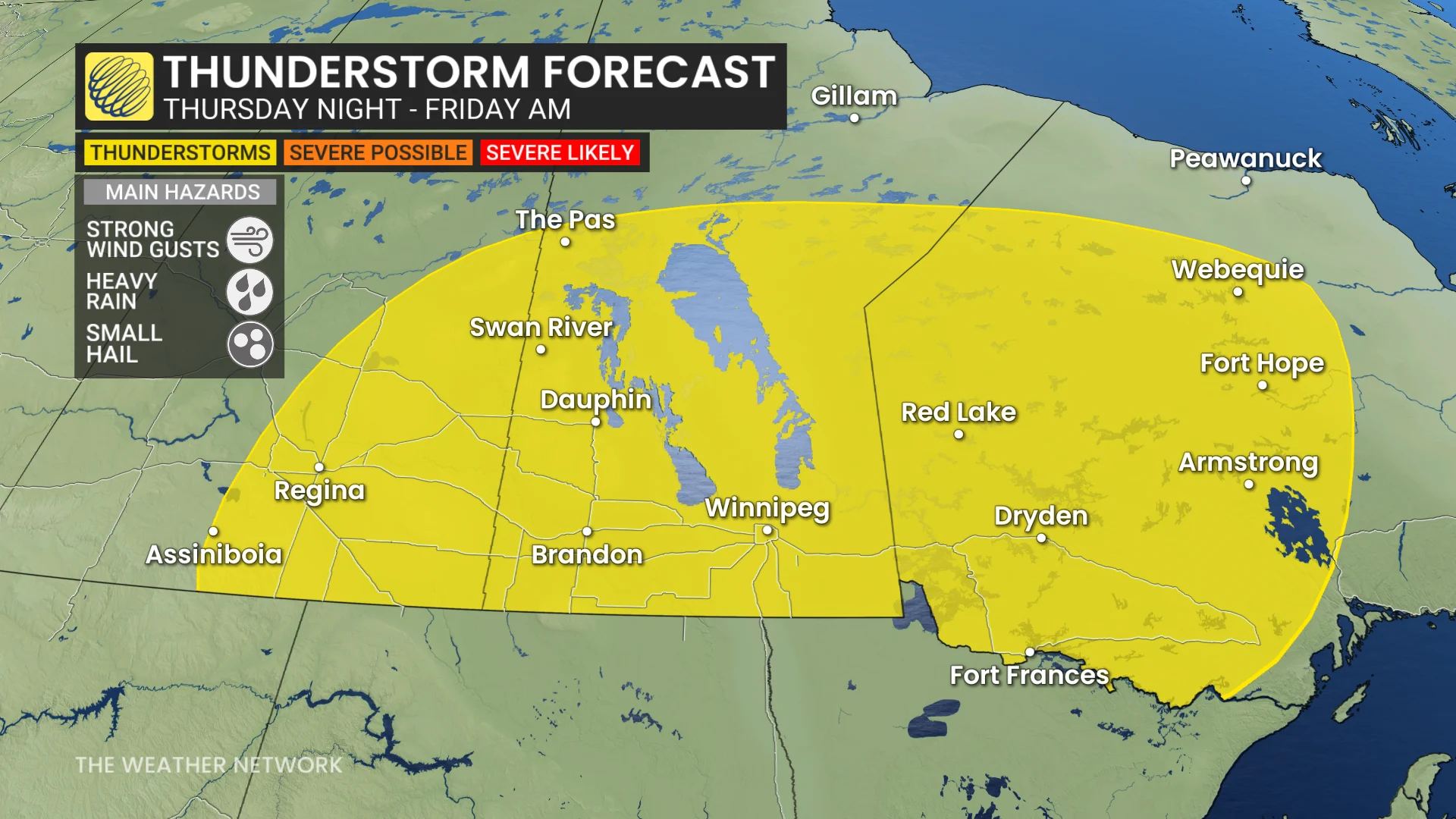
Thursday: Threat for hail up to 3-4 cm
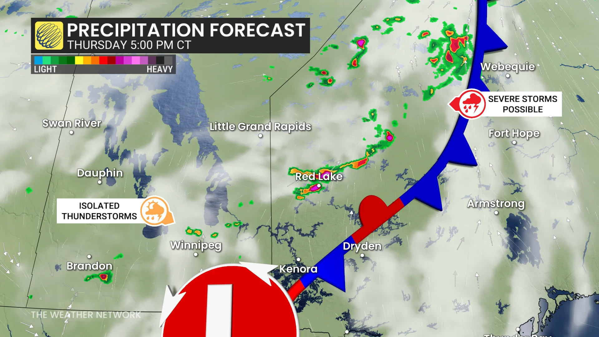
The first zone is focused along a cold front advancing through Manitoba and northwestern Ontario.
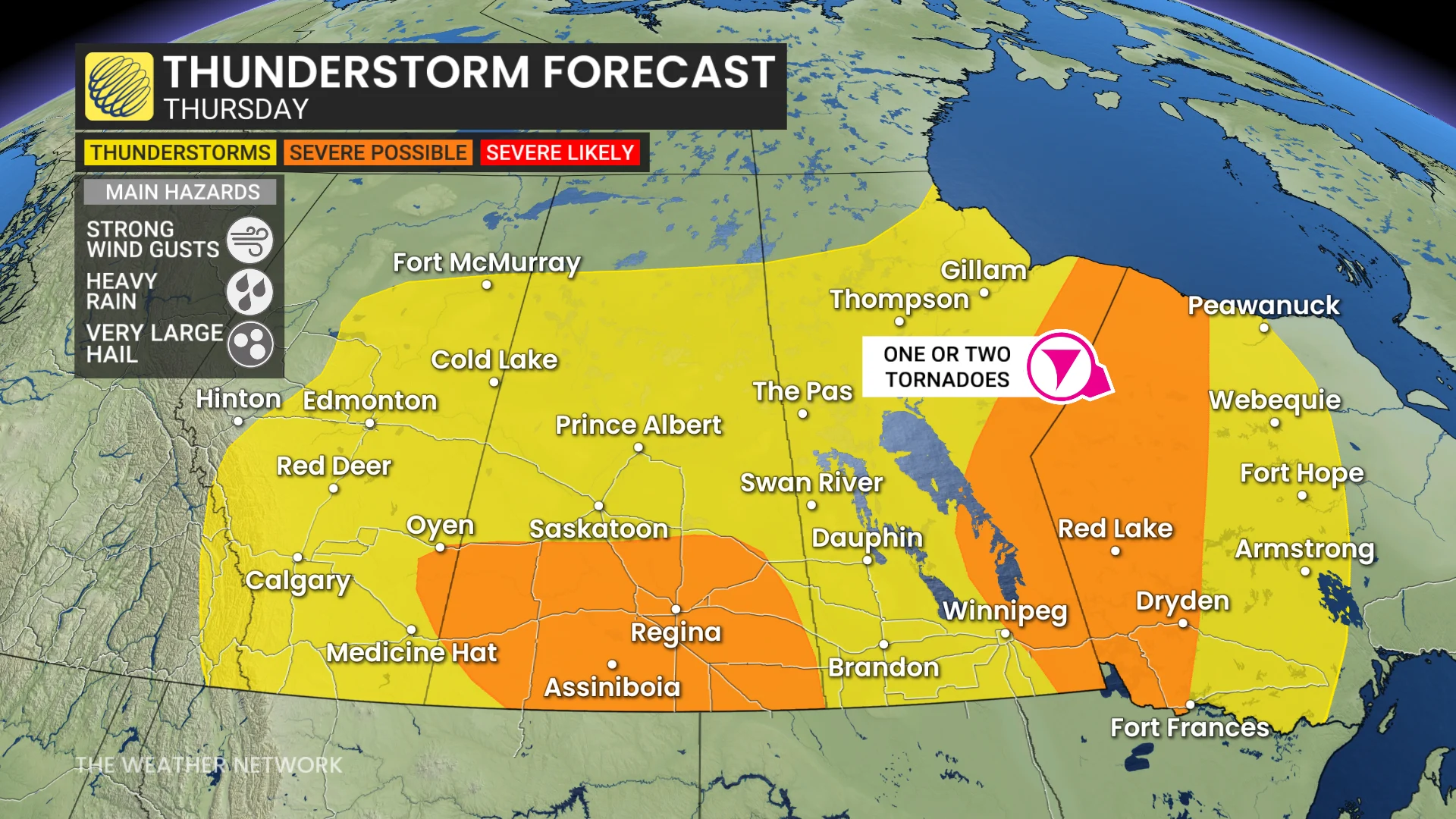
By the late afternoon, severe thunderstorms could develop along the provincial borders, extending as far north as Hudson Bay. As a cold front meets high thunderstorm energy and humidity, there is a risk for very large hail up to 3-4 cm.
DON'T MISS: From nuisance to nightmare: Huge hail is an extreme danger
While Winnipeg could see humid conditions feeling like the 40s, storm potential remains uncertain due to limited storm development signals. Confidence is higher for northern Ontario into the evening.
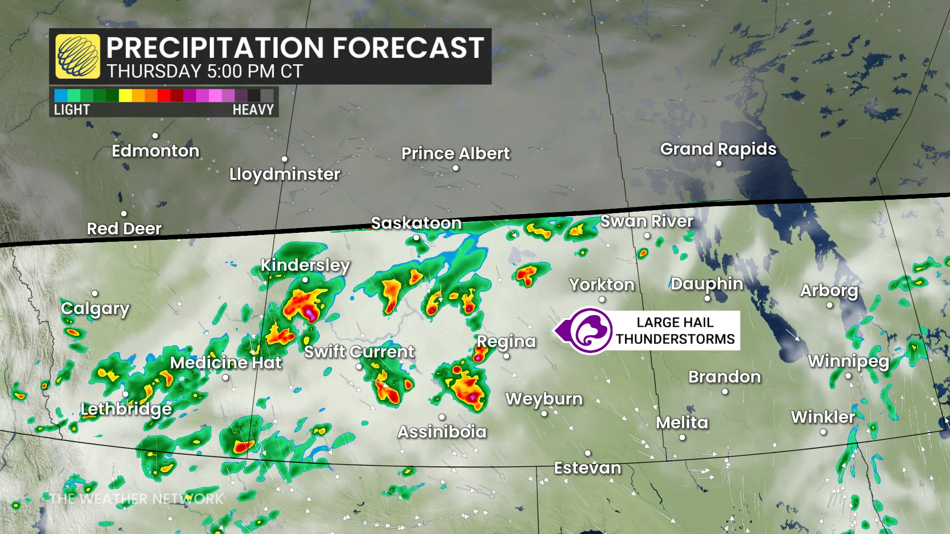
The second area spans southern Alberta and Saskatchewan.
Storms could initiate early in the afternoon near the Alberta-Saskatchewan border before tracking eastward towards Regina by evening.
DON'T MISS: What’s the wettest month in your corner of Canada?
These storms may briefly intensify into supercells before transitioning into a linear system, posing risks of 2+ cm hail, heavy rainfall, and damaging winds.
Storms may continue into southern Manitoba overnight.
Ongoing severe weather risks will linger for Manitoba and northwestern Ontario on Friday under a stalled boundary and high instability.
Stay updated on alerts and be sure to check back for the latest weather details across the Prairies.