50+ mm: Severe thunderstorms threaten heavy downpours in short time
A multi-day thunderstorm threat spans parts of southern Ontario and Quebec, with heavy downpours, large hail and strong winds on the table. Wednesday's storms could drop 50+ mm of rain in a short period of time
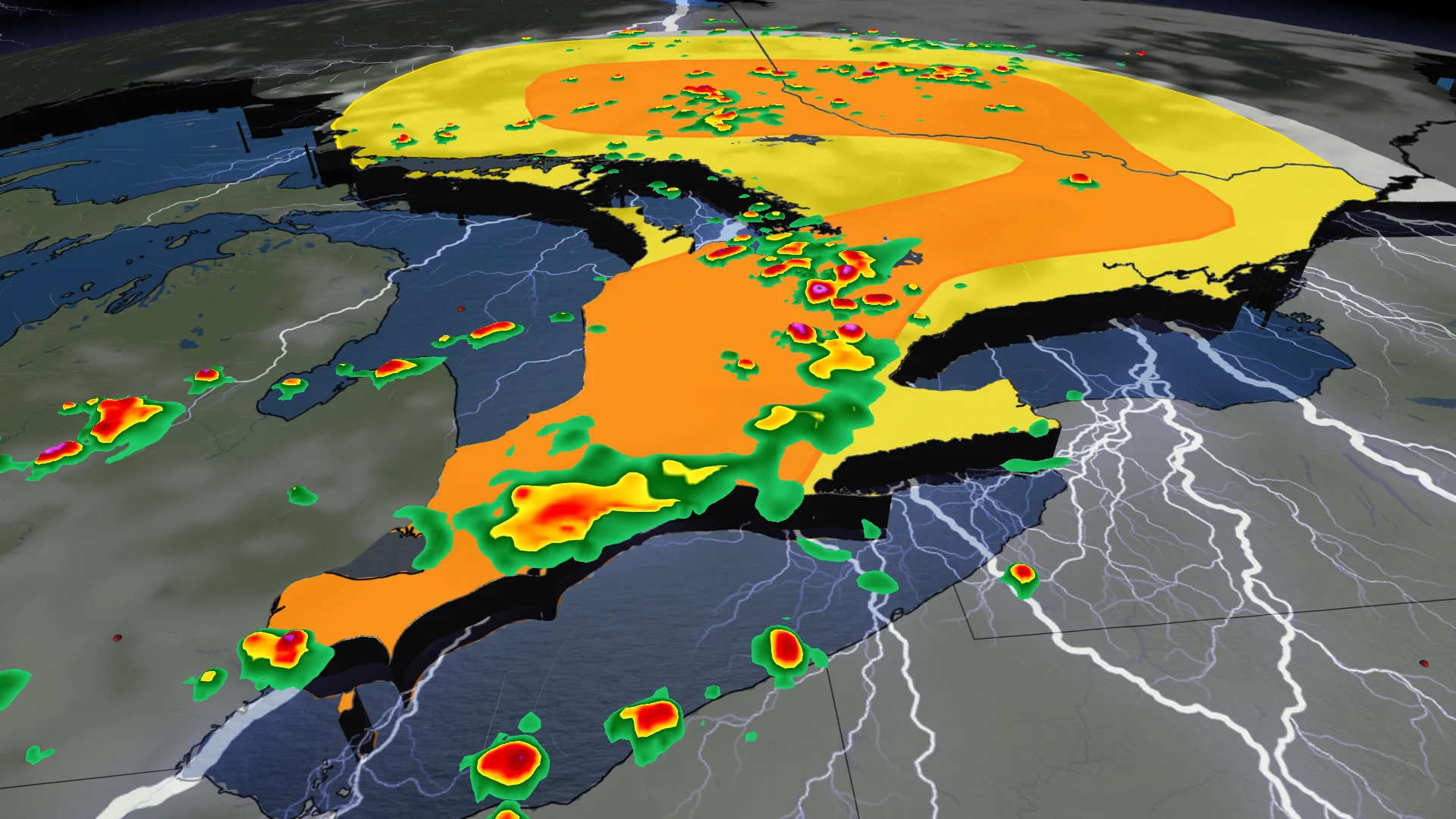
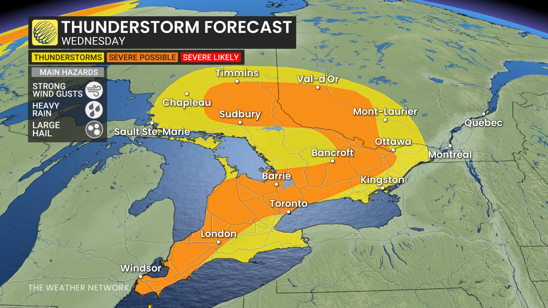
Severe thunderstorms are forecast to sweep across much of southern Ontario Wednesday afternoon and evening, with potential impacts to commutes, and localized flooding in some areas.
DON'T MISS: The Weather Network's exclusive summer 2025 forecast
The storm risk will shift into eastern Ontario and southern Quebec by Thursday, where isolated storms could bring heavy downpours, near 2 cm-sized hail, and strong winds.
You'll want to stay updated on the weather alerts in your area as conditions can change quickly when severe weather hits.
Wednesday: Heavy rain threatens commute times in southern Ontario
A low-pressure system moving through the Great Lakes will spark thunderstorms early Wednesday afternoon in regions such as Windsor, London, and areas north to Collingwood.
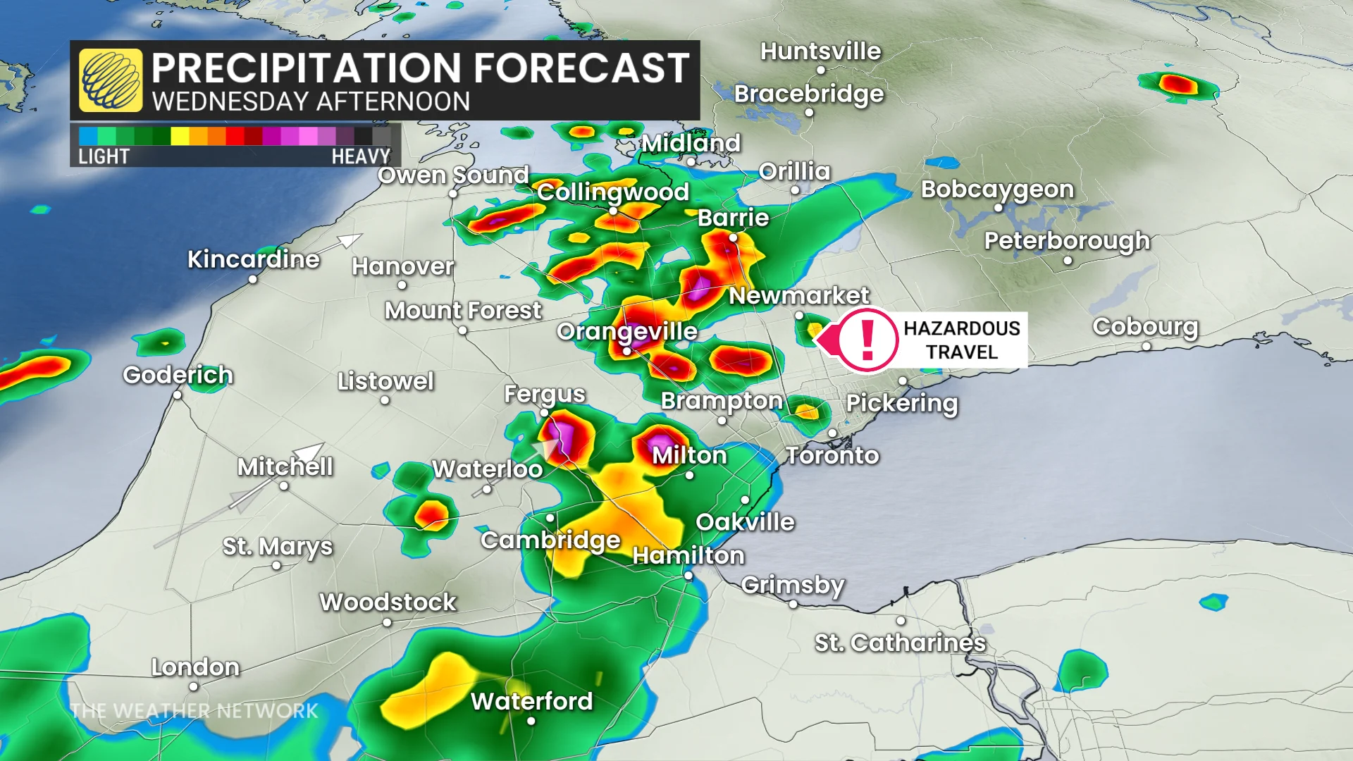
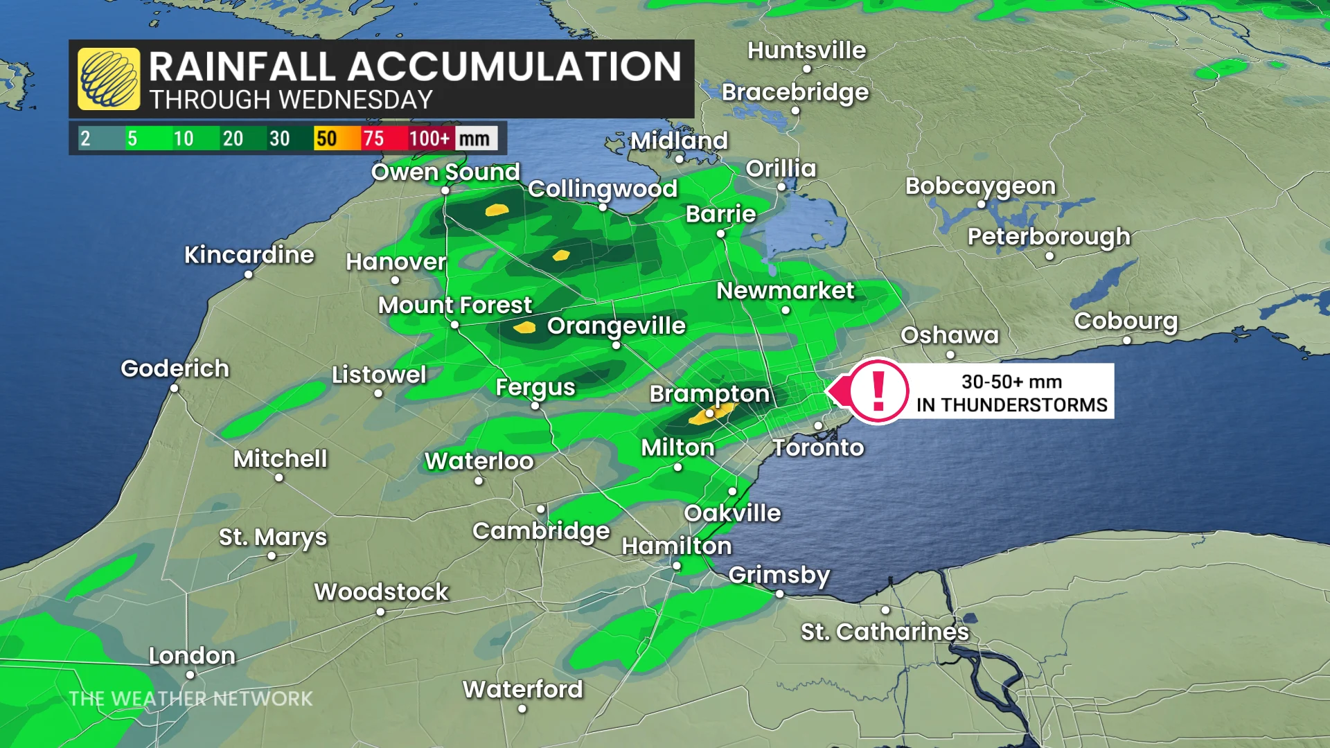
These storms are expected to track northeast, reaching the 401 and 400 corridors between 3 and 4 p.m. Heavy downpours could bring 30-50+ mm of rain in short bursts, increasing the risk of localized flooding, particularly in the northern GTA.
SEE ALSO: Recalling the historically bad commute when the GTA flooded in 2013
Threats from these thunderstorms include hail up to two centimetres in size and strong wind gusts. Commuters are encouraged to stay weather-aware as slow travel is likely during the evening.
Thursday: Storm threat shifts east with risk for large hail and strong winds
Conditions will shift eastward Thursday, with severe storms possible in eastern Ontario, including Ottawa, and areas along the St. Lawrence River, such as Montreal and Quebec City.
DON'T MISS: What’s the wettest month in your corner of Canada?
By the afternoon, expect another risk for widespread, scattered storms, bringing heavy downpours, near two- to four-centimetre-sized hail and strong winds.
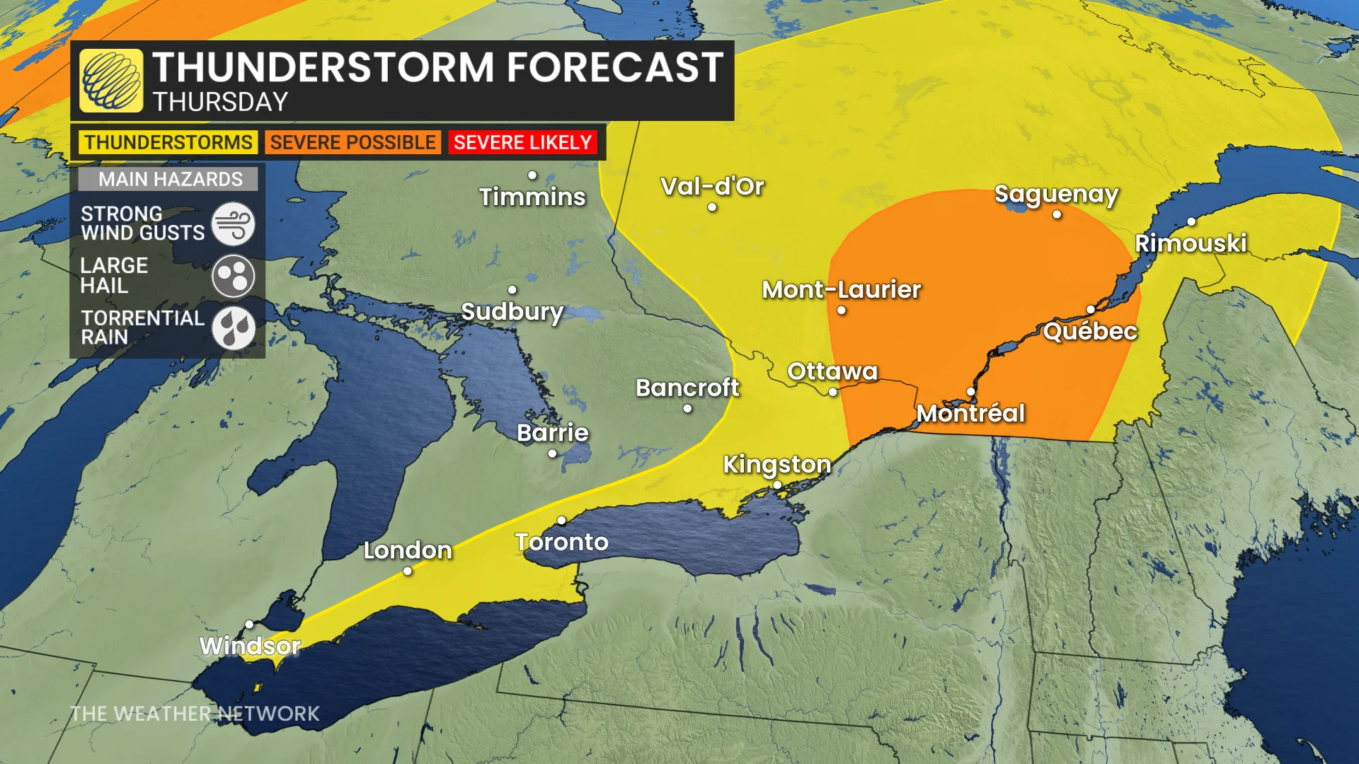
Significant instability will fill the St Lawrence Valley, and ample moisture will stretch north into the Laurentians, bringing a localized flooding threat.
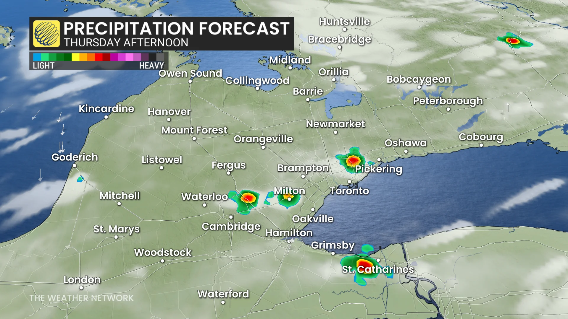
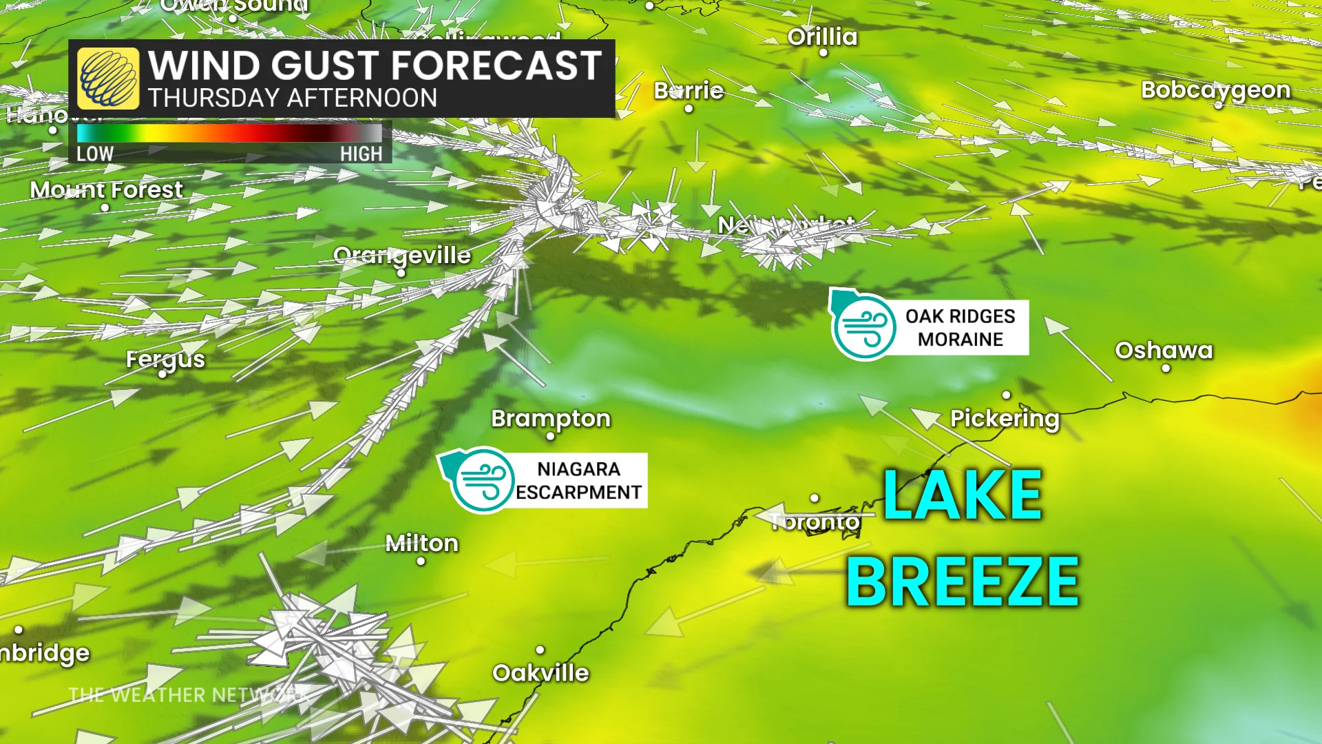
The Greater Toronto Area (GTA) will see the risk of a few storms developing as the Lake Ontario lake breeze interacts with the Niagara Escarpment and the Oak Ridges Moraine, in the late-afternoon and early-evening periods.
The same risk will occur inland from Lake Erie. With these storms, heavy rain will be the only hazard.
Be sure to check back for the latest weather updates across Ontario and Quebec.