
Tornado warning issued in southern Ontario as severe storms pop up
A severe thunderstorm capable of producing a tornado has been detected in southern Ontario. Residents in the affected region should be in their shelters.
A tornado warning has been issued in southern Ontario as meteorologists with Environment and Climate Change Canada (ECCC) are tracking a thunderstorm that is potentially producing a tornado.
In addition to potentially producing a tornado and intense winds, large hail and locally intense rainfall are possible. See below for the details.
Current tornado warnings
Hanover - Dundalk - Southern Grey County
3:06 PM EDT: Environment Canada meteorologists are tracking a severe thunderstorm that is possibly producing a tornado. Damaging winds, large hail and locally intense rainfall are also possible.
A severe thunderstorm capable of producing a tornado is located 5 kilometres southeast of Eugenia, moving east at 35 km/h.
Hazard: Tornado.
Locations impacted include: Flesherton, Eugenia and Badjeros.

This is a dangerous and potentially life-threatening situation.
Take cover immediately, if threatening weather approaches. If you hear a roaring sound or see a funnel cloud, swirling debris near the ground, flying debris, or any threatening weather approaching, take shelter immediately.
Go indoors to a room on the lowest floor, away from outside walls and windows, such as a basement, bathroom, stairwell or interior closet. Leave mobile homes, vehicles, tents, trailers and other temporary or free-standing shelter, and move to a strong building if you can. As a last resort, lie in a low spot and protect your head from flying debris.
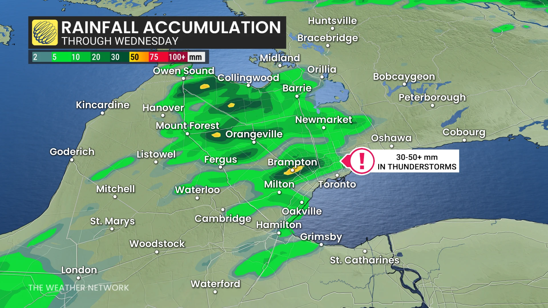
Wednesday: Heavy rain threatens commute times in southern Ontario
A low-pressure system moving through the Great Lakes will spark thunderstorms early Wednesday afternoon in regions such as Windsor, London, and areas north to Collingwood.
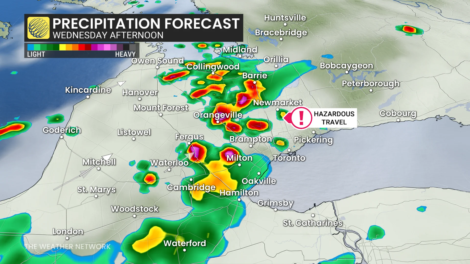
These storms are expected to track northeast, reaching the 401 and 400 corridors between 3 and 4 p.m. Heavy downpours could bring 30-50+ mm of rain in short bursts, increasing the risk of localized flooding, particularly in the northern GTA.
SEE ALSO: Recalling the historically bad commute when the GTA flooded in 2013
Threats from these thunderstorms include hail up to two centimetres in size and strong wind gusts. Commuters are encouraged to stay weather-aware as slow travel is likely during the evening.
Thursday: Storm threat shifts east with risk for large hail and strong winds
Conditions will shift eastward Thursday, with severe storms possible in eastern Ontario, including Ottawa, and areas along the St. Lawrence River, such as Montreal and Quebec City.
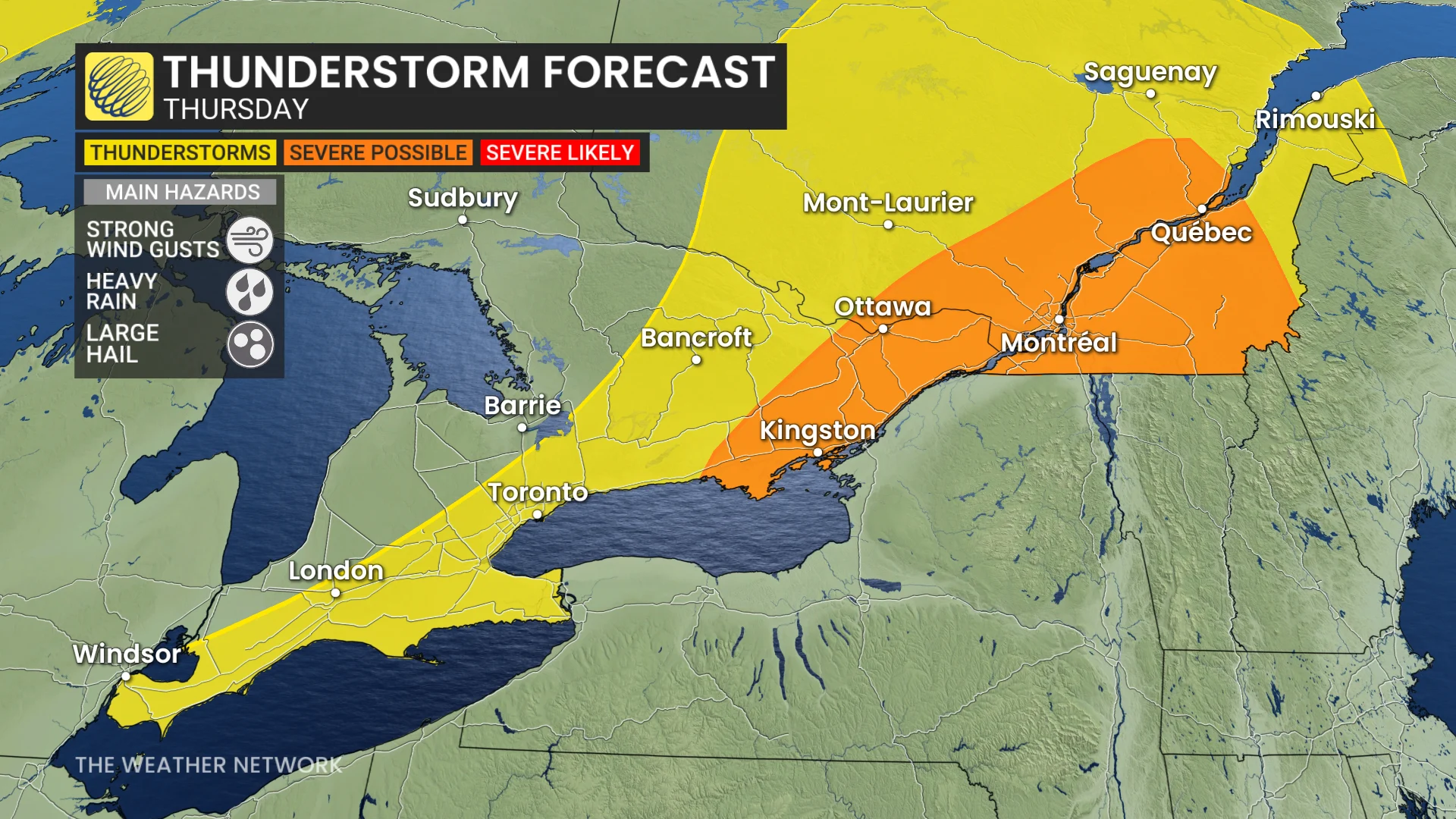
Another round of heavy rainfall, hail, and strong winds could develop during the afternoon.
DON'T MISS: What’s the wettest month in your corner of Canada?
Although the storm risk remains for southern Ontario Thursday, forecast confidence in exact locations remains lower.
Be sure to check back for the latest weather updates across Ontario and Quebec.