Severe weather set to hit multiple parts of Canada this week
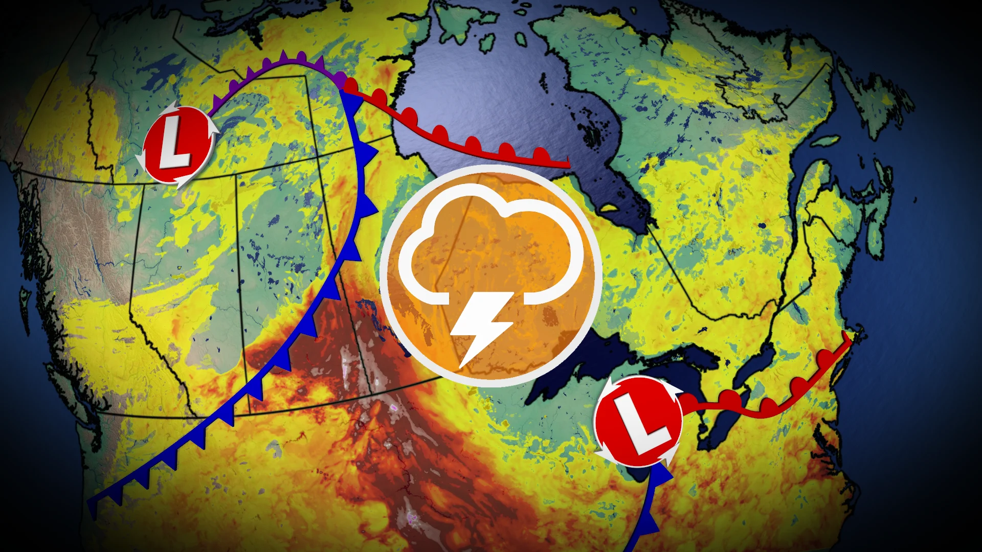
Two notable troughs will bring multiple days of storms to the Prairies, Ontario, and Quebec for this second week of July
Summer is in full swing, and mid-week severe weather potential is developing across numerous regions in Canada.
DON'T MISS: The Weather Network's exclusive summer 2025 forecast
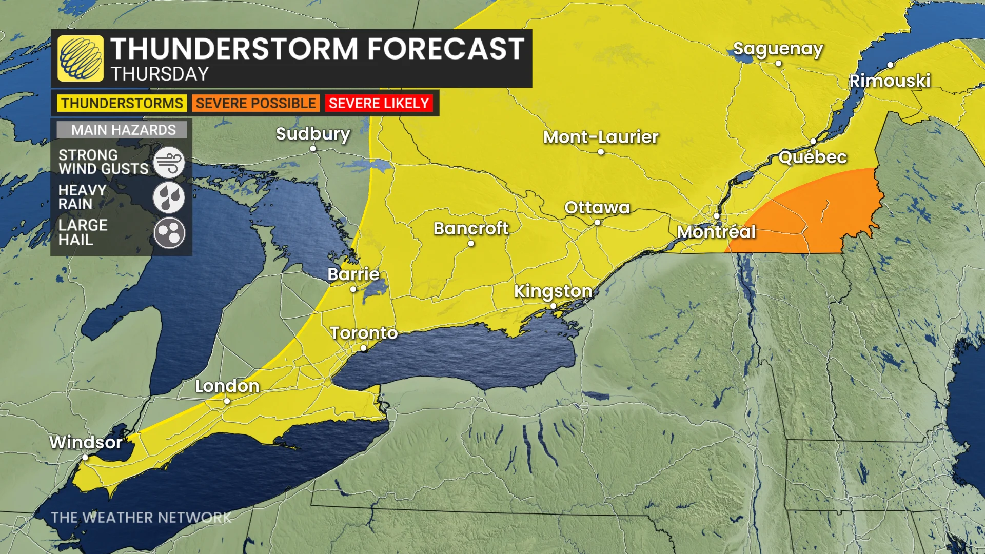
In Ontario and Quebec, a low pressure system will move into the Great Lakes on Wednesday, shifting east by Thursday.
Southern Ontario may see widespread, but isolated thunderstorms by late Wednesday morning.
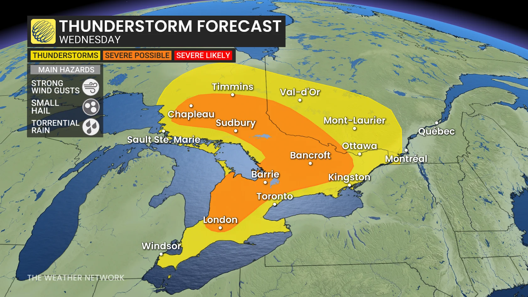
Northeast and eastern Ontario could experience storms by the afternoon and evening on Wednesday, and there is still some uncertainty if these storms will impact the Greater Toronto Area (GTA).
DON'T MISS: What’s the wettest month in your corner of Canada?
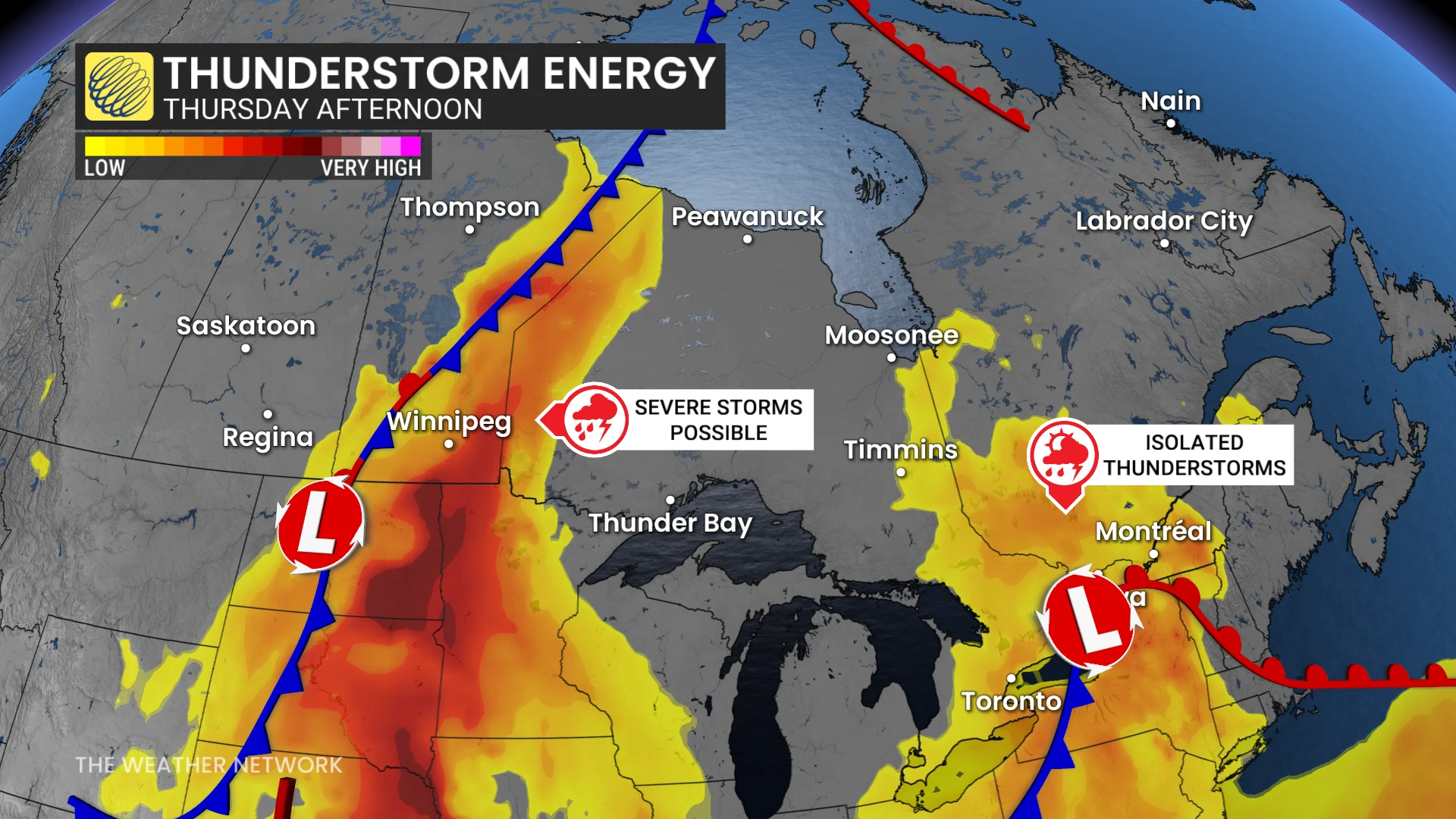
By Thursday, the risk of severe thunderstorms moves into southeastern Quebec, where afternoon storms may bring strong winds and heavy downpours in a humid air mass.
Meanwhile, a system moving across B.C. will carve a sharp cold front across the Prairies. Combined with recent 30°C heat, this setup will create significant storm energy.
On Wednesday, the thunderstorm risk will extend from Red Deer and Calgary, Alta., through central Saskatchewan, and into northern Manitoba.
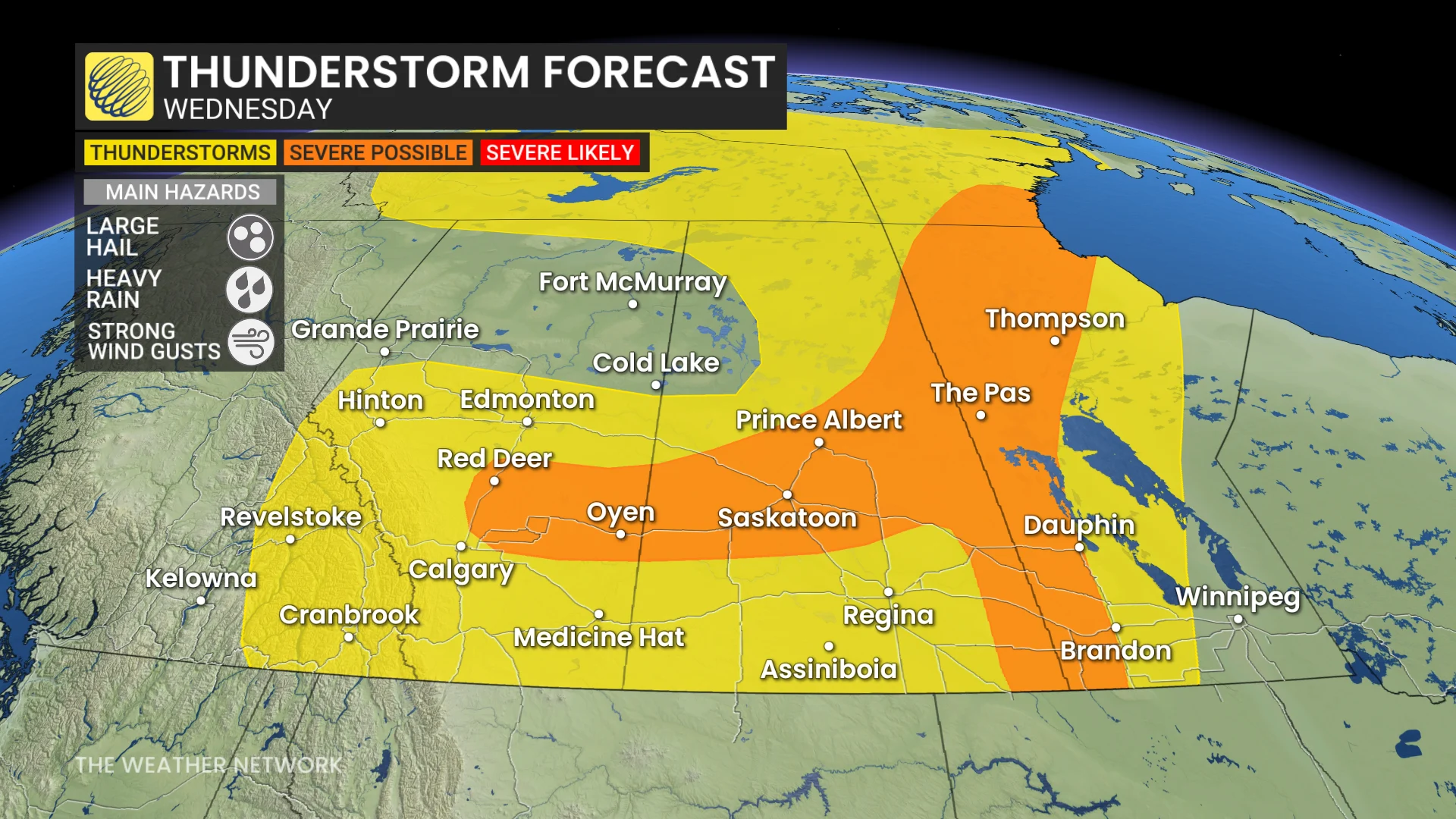
Southern areas of Saskatchewan and Manitoba could see very high storm energy; however, factors such as a cap and lack of triggers may limit development.
By Thursday, the risk expands to include much of Manitoba, potentially reaching Winnipeg and northwestern Ontario. Storms may produce large hail and strong winds.
Confidence remains low for exact locations, so you'll want to continue to check back and stay updated as risk areas may shift closer to the event.