
Severe storms, tornado risk target Alberta before shifting east
Favourable conditions will bring widespread thunderstorm risk to the Prairies, with some storms Thursday and Friday bringing strong winds and hail.
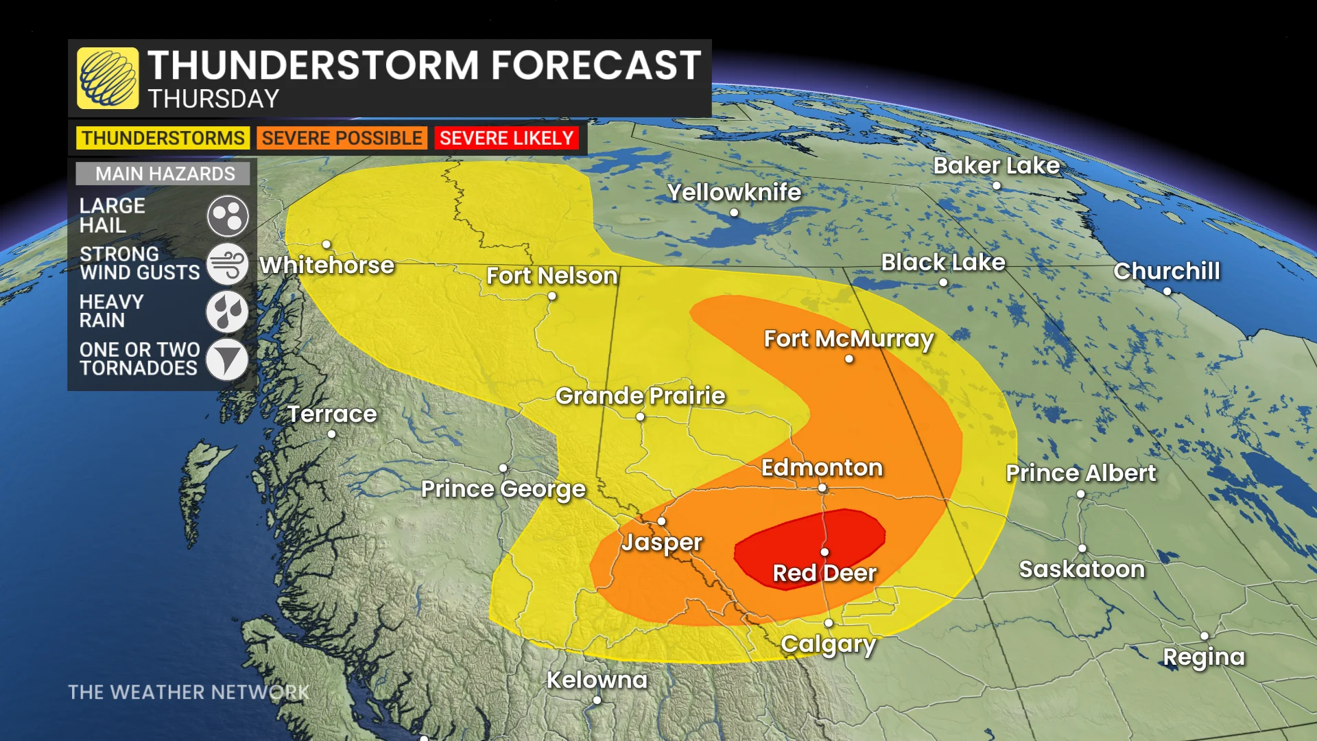
Thunderstorm activity is expected to escalate on Thursday and Friday, with Alberta facing the highest risk initially before the threat shifts eastward.
Severe storms in parts of Alberta on Thursday could bring heavy downpours and large hail, with some hailstones potentially exceeding two centimetres in diameter.
SEE ALSO: Jasper rising from the ashes: A journey of recovery one year later
You'll want to stay updated on the weather alerts in your area as conditions can change quickly when severe weather hits.
Thursday: Severe storm risk grows over Alberta
Storm activity on Thursday will concentrate in central and northern Alberta, with instability building from the foothills through Fort McMurray.
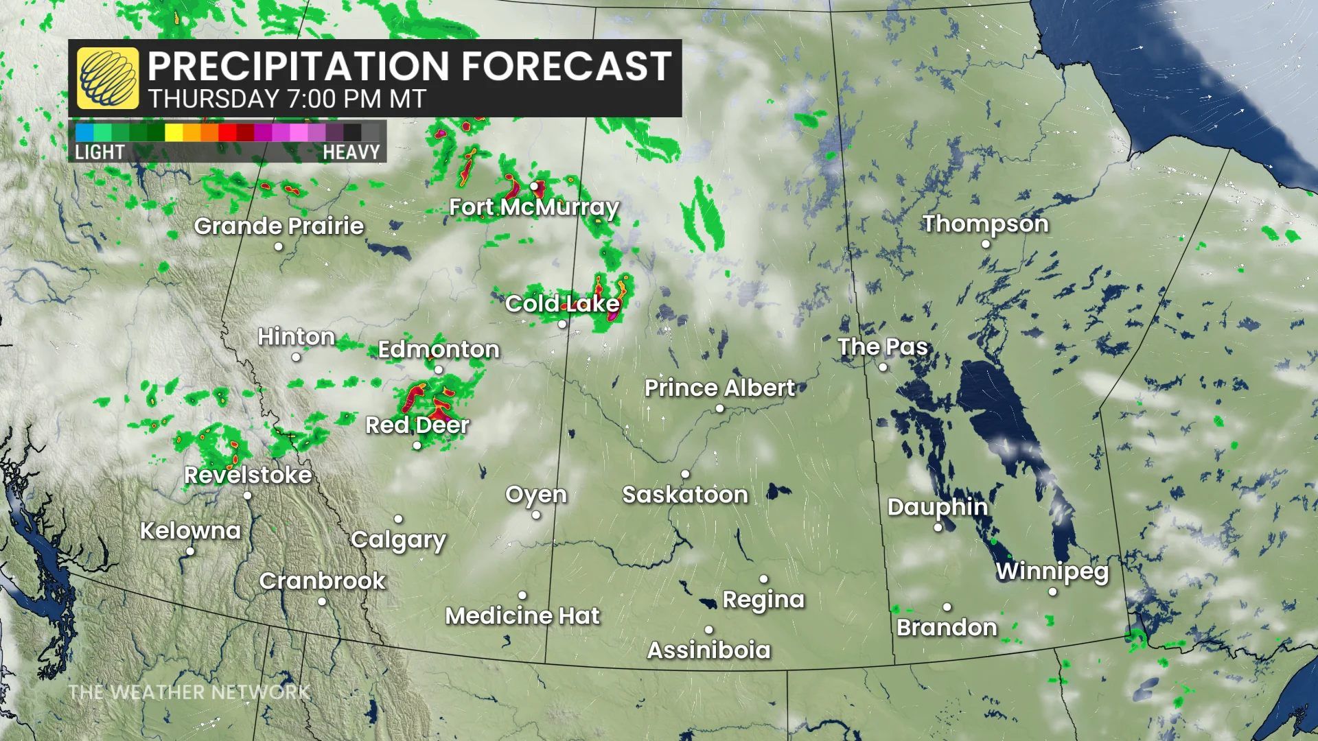
Severe thunderstorms may develop along the QE2 corridor between Red Deer and Edmonton, starting late afternoon and moving eastward into the evening hours.
DON'T MISS: From nuisance to nightmare: Huge hail is an extreme danger
Evening commuters may face travel disruptions due to heavy downpours and large hail exceeding 2 cm in diameter. Enhanced wind shear along the QE2 could also increase the tornado risk and boost the potential for larger hail.
More widespread risk across the Prairies for Friday
By Friday, the thunderstorm risk will expand across much of the Prairies, with isolated storms possible throughout the region.

However, the strongest severe thunderstorm threat will shift eastward to Manitoba’s Interlake region, where storm energy and a frontal trigger will be most pronounced.
Warmer weather returns
Following this week's frost and even snow threat for parts of the Prairies, warmer weather is set to return next week, bringing much higher temperatures across the region.
Highs are expected to reach the upper 20s to lower 30s, with southern Alberta and southwestern Saskatchewan potentially climbing to the mid-30s.
Snow is also possible early next week in the Rockies above 2,000 metres, while central and southern Alberta face a sharp cooldown with highs 10 to 15 degrees below seasonal before warmer weather returns.
SEE ALSO: Wildfire smoke, other extreme weather affecting Ontarians' vision: Poll
Looking ahead to the first week of August, a cooler and unsettled weather pattern is forecast to take over. This may bring above-normal precipitation to portions of Alberta and Saskatchewan.
However, rainfall in northern Manitoba's wildfire-affected regions is expected to remain minimal, providing limited relief for the ongoing fire activity there.
Stay tuned to The Weather Network for the latest forecast updates for the Prairies.