Tornado watch issued in southern Alberta as storm threat builds Sunday
Southern Alberta braces for a dramatic shift in weather, with severe storms and a sharp temperature drop expected early this week.
12:22 p.m. MDT - A tornado watch is in effect across portions of southern Alberta amid a severe storm threat on Sunday afternoon. A tornado watch means that conditions are favourable for the development of tornadoes.
Any severe storms that develop may also be capable of producing damaging hail, heavy rain and strong wind gusts, Environment and Climate Change Canada (ECCC) added in its watch.
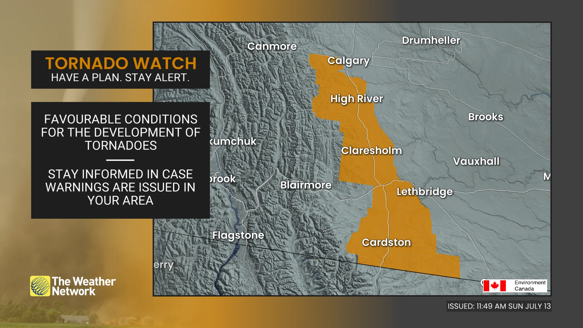
Pay close attention to the latest alerts in case the tornado watch is upgraded to a tornado warning in your area. Have a plan in place to seek safe shelter in case severe weather threatens your home, your office, or while you’re driving.
The original article with the full forecast for Alberta continues below.
As the Calgary Stampede nears the end of its ten-day run, the weather prepares to take centre stage.
What began as a sunny celebration is about to take a sharp turn, with storms, a significant temperature drop and even summer snow in the forecast for parts of southern Alberta.
While July is known for its unpredictability, this sudden cooldown is unusual even by prairie standards.
MUST SEE: Beware: Flood insurance isn't guaranteed and the type you have can vary
Severe storms could impact final Stampede events
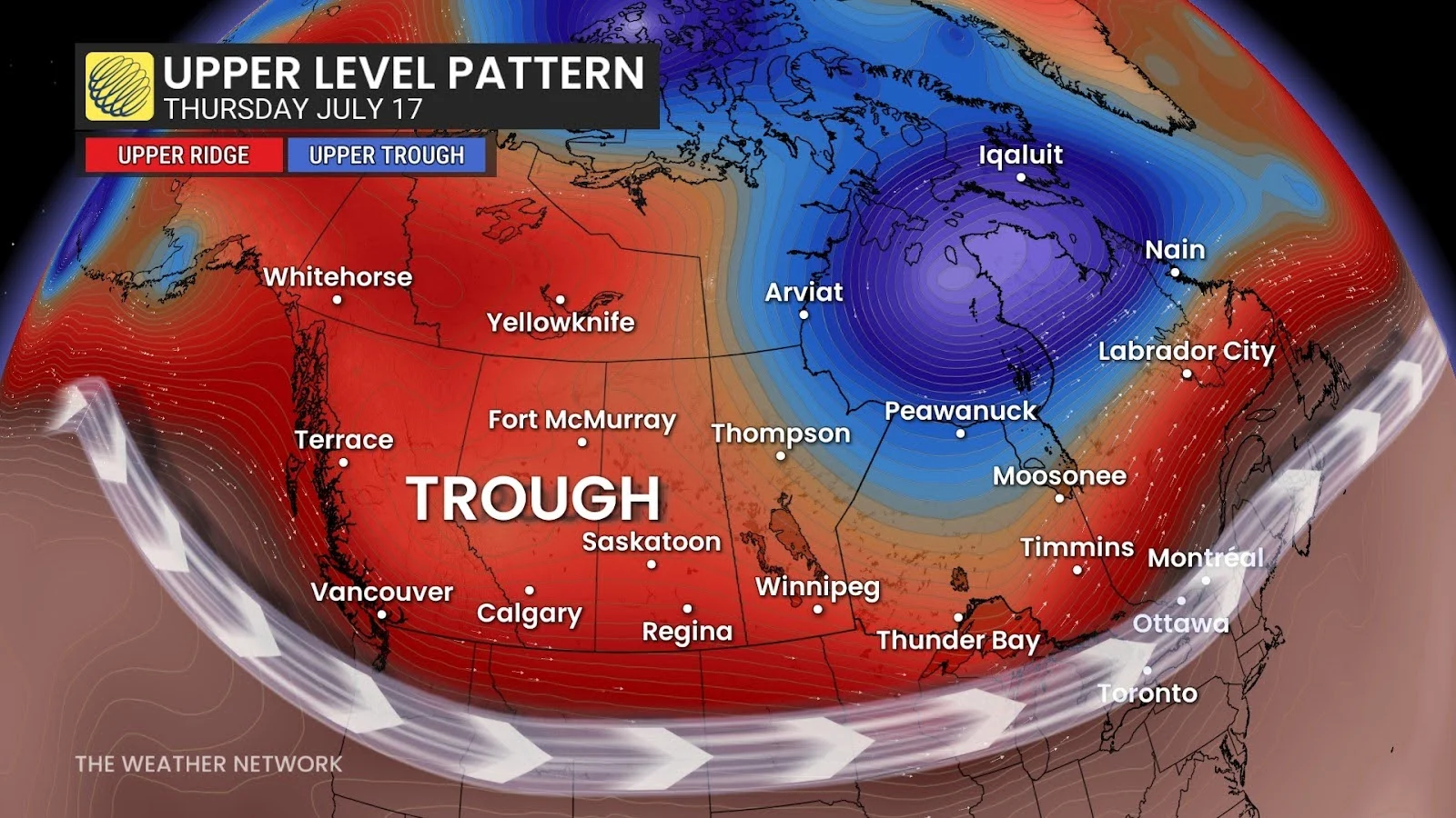
The final day of the Stampede on Sunday is anticipated to bring more than just fireworks. A Montana low, working in tandem with an upper-level trough, is expected to cause strong thunderstorms along the foothills.
The storms are projected to develop in the afternoon and evening before moving southeast across Calgary, Medicine Hat and Lethbridge.
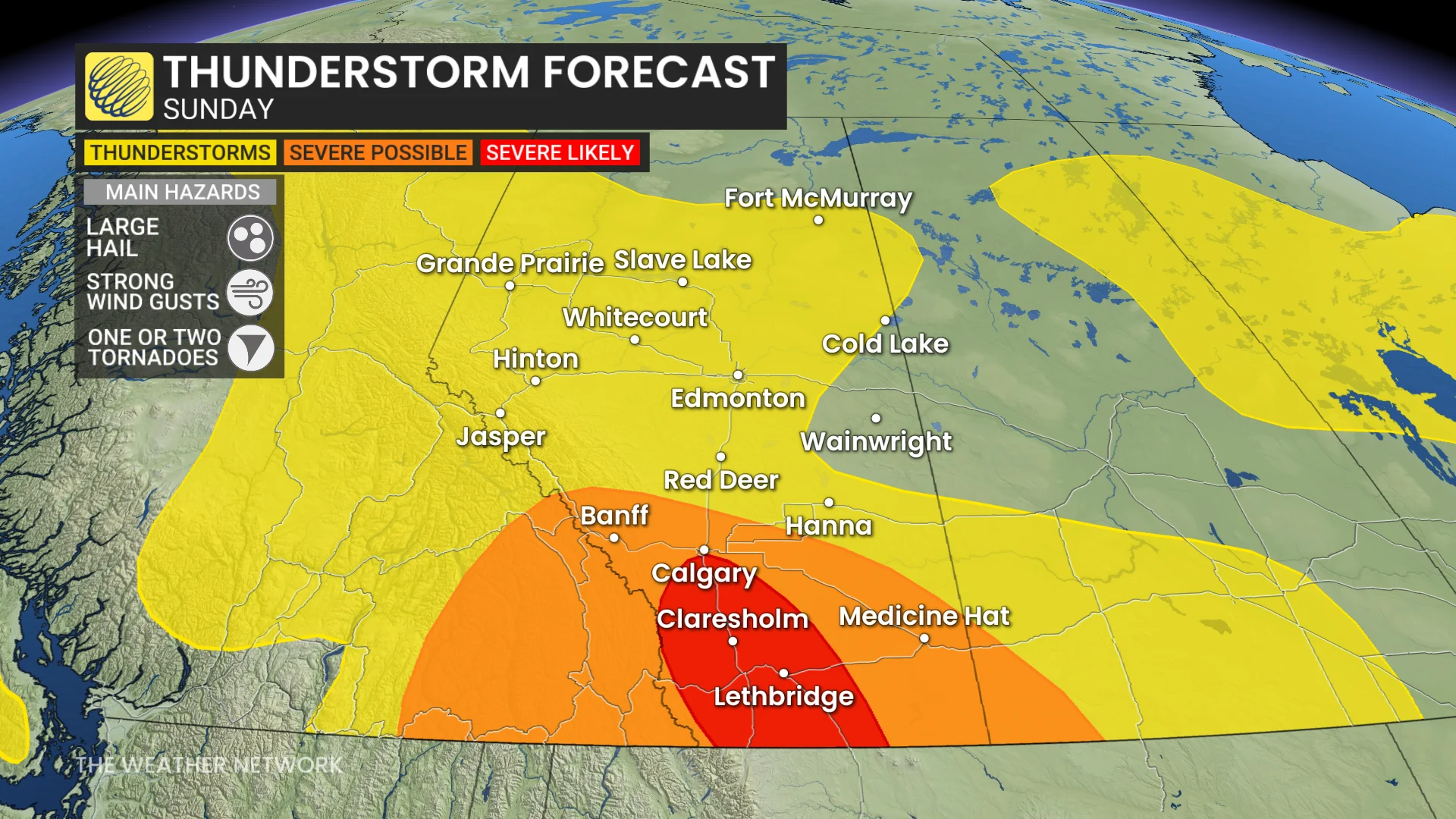
Heavy rain, large hail and strong wind gusts are all possible as the system passes through. Localized flooding and toppled structures may occur, especially in areas with poor drainage.
SEE ALSO: Trapped in your car in floodwaters? This tool can help you make a quick escape
Stampede attendees are advised to keep an eye on the skies and plan ahead of time where they will seek shelter if the weather changes.
Temperatures tumble as rain and even snow hit the Rockies
By Monday, southern Alberta will be experiencing very different weather.
A cold front will cause temperatures to drop 10 to 15 degrees below seasonal averages, while rain will blanket the region from Calgary to the Rockies.
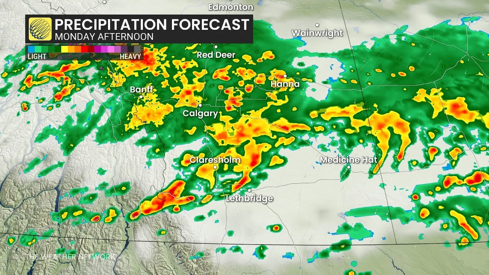
Rainfall amounts in Calgary, Banff and Canmore could reach 30 to 50 millimetres by Wednesday, with 20 to 40 millimetres expected from Medicine Hat to Lethbridge.
Jasper and the surrounding areas could see up to 50 millimetres. A brief break is expected on Tuesday before the rain returns within the middle of the week.
DON'T MISS: Having nightmares? Blame the heatwave
Colder air moving in may lower freezing levels to 2,300 metres, bringing the possibility of summer snow to higher elevations, including Jasper National Park.
Snow-capped peaks in the middle of July can seem surreal to mountain travellers. However, despite the cold air, this will not be a record-breaker.
Calgary's coldest July day remains 7.3ºC, set in 1884. Still, after the recent summer heat, Monday's forecast will feel like a step into another season.
Impacts:
Anyone attending Calgary Stampede events or travelling through southern Alberta should be weather-aware. Strong winds, hail and flooding could result in hazardous conditions on roads and outdoor venues.
Rain and cooler temperatures may continue through Wednesday, with a brief dry break on Tuesday.
Be sure to check back for the latest weather details across Alberta and the Prairies.